• Skip to primary navigation
  • Skip to main content
  • Skip to primary sidebar

ExploreTraveler

Helping bring the world togeather one friend at a time. So travel and discover that the world is full of wonderful people.


  • Home
    • Pilgrimtraveler
    • Prepping Foods
  • About Us
  • Taiwan Travel Questions
    • Taiwan Travel Guide
    • Taiwan Photo Gallery
    • Taiwan Video Gallery
  • Destinations
    • Asia
      • Hong Kong
      • India
      • Indonesia
      • Iraq
      • Israel
      • Japan
      • Jordan
      • Malaysia
      • Philippines
      • Taiwan
      • Thailand
    • Europe
      • Belgium
      • Germany
      • Netherland
      • Portugal
    • Middle East
      • Iraq
      • Israel
      • Jordan
    • North America
      • Canada
      • Mexico
      • USA
  • Food Travel
  • Forum
  • Free Signup
    • Membership Account
  • Write For Us
Home » Asia

Asia

A Malaysian Experience

September 4, 2019 by Exploretraveler.com Leave a Comment


The Straits Of Malacca In Beautiful Malaysia

Perhaps one of the most extreme examples of beauty can be found in the Strait of Malacca. This magnificent waterway provides the connection between the Andaman Sea, also known as the Indian Ocean, and the South China Sea, which is a part of the Pacific Ocean. This breathtaking strait runs between Sumatra, an island of Indonesia, and Peninsular, Malaysia. The very most Southern part of Thailand forms the border on the east. With Sumatra on the West and Peninsular and Thailand to the east, it is a major waterway connecting many different cultures and countries. The strait consists of 25,000 miles making it a waterway to be noted.

There can be no better place to begin your Malaysian experience than on the shores of the Malacca Strait.  It does not matter if you come when the sun is shinning, or when it is setting, beauty is everywhere.

The Strait of Malacca combines with the Singapore Strait providing the main route between the Indian and Pacific Oceans. There is no shorter way to move tankers between Japan in Asia and the Persian Gulf.

The Romantic Malay Peninsula

The Avani Sepang Goldcoast Resort in Selangor, Malaysia is a Malaysian gem of elegance and adventure wrapped into one package. Your suite will be one of over 300 suites that are out over the water. They are very private and deluxe accommodations. Your beach front accommodation will provide you with a wealth of culture and all the adventure you desire. Kuala Lumpur International Airport is only a short drive away, taking about 40 minutes.

The food is suburb.  There are five restaurants and bars, plus one lounge. The choices are not quite endless, but they offer a vast array of refreshing drinks and many International favorites. You can relax by the pool and sip on a nice cool refreshing drink or even grab a bite at the pool side. Dine outside on the deck overlooking the water while enjoying the sunset and many different entertainment options. If you prefer, you can come on inside for dinner and dine in luxury while enjoying the air conditioned dinning room. There are a good selection of local Malay and Chinese specialties offered, as well as specialties from all over the world. If you prefer the seclusion of your private room, there is room service. It is Whatever you want to do, when you want to do it. This is a Malaysian gem!

Tasty Temptations From The Sea

Enjoy anything from the finest lobster, to the many fresh local fish, all kept on ice till they are cooked in any number of fine ways. The Avani Sepang Goldcoast Resort, with it’s five international restaurants, offer only the freshest fish. The fish is supplied from the local fisherman daily, as in all of Asia. Fresh means just off the boat. What an adventure in eating awaits you in this tiny corner of paradise!

Relax On The Deck Overlooking The Water

Relax by the water and enjoy your drink, or just enjoy the scenery that is all around you. Under the covering of the umbrella, you can even catch a short nap. Just want to rest and relax, maybe read a good book, the choices are endless. Whatever you enjoy doing as you gaze out over the water, the options are almost endless. Just lean back and relax, the choices are yours.

The National Monument overlooking Kuala Lumpur

Just a short walk from the magnificent Lake Gardens at Kuala Lumpur is this National Momment. The bronze sculpture was built to remember the sacrifice many brave soldiers made for the freedom of their country. This historic sculpture is one of the tallest groups of bronze sculptures. Another amazing mark in history.

There are many different attractions to do at Kuala Lumpur’s National Monument. The beautiful Lake Gardens provide miles of greenery. It’s lush vegetation is inviting to those who desire rest and relaxation from the concrete jungle of the business world. A short walk through the park from the monument and you will discover the spectacular Lake Gardens. There is not a garden so magnificent anywhere else in Malaysia.

Walking yet a little farther and you will discover the Kuala Lumpur Bird Park. This is one of the most renowned aviaries in the entire world with over 200 separate species represented among the more than 3,000 birds. Take time to do a photo shoot and feed the beautiful birds. Other major attractions the Kuala Lumpur Butterfly Park with what seems like an endless variety of butterflies. Close by the Bird Park is the Kuala Lumpur Deer Park with several species of deer from all over the world on exhibit. Like the Bird Park, you are welcome to feed the animals and take photos.

Among the deep greens of Kuala Lumpur park you will find a beautiful Hibiscus Garden and an Orchid Garden with species of the Orchid plant from all over the world. If you are looking for beauty, you will find it among these two gardens that are just waiting to be discovered.

Central Market Kuala Lumpur Malaysia

The life of this iconic market began in 1888. It was then that Yap ah Loy, the Kapitan of the city at the time, built the wet market. This market served as a central landmark in colonial Kuala Lumpur. In the modern city of Kuala Lumpur this market continues to take an important place in the lives of the people. In the 1980s, the Malaysian Heritage Society campaigned to have the market relocated, saving it from almost certain demolition. Even to this day, this Central Market continues to be an iconic landmark. It is a major destination for locals and tourists, as well as those who just love the arts. If it is shopping you desire to do, then this is the perfect market. Inside it’s walls you will discover local boutiques as well as major chain stores. It is the perfect place for the shopper of the family to spend a few hours searching for that perfect gift, or just to explore the many different and unique shops that you will find.

A Malaysian Experience - A person standing next to a body of water - Boating

Boating Through The Mangroves

Boating through the Mangrove Jungle in the Negeri Sembilan Peninsula Malaysia is an incredible experience. While the mangroves only make up about two percent of Malaysia, they are home to many species of mollusk, shrimp, crab, and a variety of other small fish. These are a major food source for the people living in the coastal communities. These dense and protected forests also provide a place for many different species of fish to hatch and grow into adults safely. Many of the fish found in the coral reefs, had their start in the mangroves. Shrimp, crab, and a variety of other small fish all had their beginnings in these dense waters. 

A Malaysian Experience - A body of water - Nature reserve

Mangrove jungle in Malaysia
The mangroves are the salt loving rain forests of the tropical seas. Trees and shrubs that love to exist in salt water call this dense tropical forest by the sea home. Not only is it one of the world’s most diverse ecosystems, it is one of the most valuable. It also serves to protect the communities along the coast from many natural disasters. It certainly has earned a special place in the hearts of the local communities. The health of the community is often measured by the health of the mangrove.
The Seedlings Are Ready
The amazing mangroves are filled with seedling, ready to drop off and take root. This process continues and keeps the mangroves thick and lush. As the mangroves replenish themselves year after year, so their value as a storm break for the main island increases. The thicker the mangrove, the less that any tropical storm will harm the villages that depend on them for protection.
Gathering The Seedlings 
On occasion someone comes along to help the seedlings out. Eventually the seedlings will fall into the water and reproduce on their own, but a little help assures that more of the seedlings take root and grow. Sometimes it is just nice to receive a helping hand, as each seedling is very important to the ecosystem.
A Helping Hand

Filed Under: Asia, Indonesia, Malaysia, Thailand, travel the world, Travel Tips, World Travel Tagged With: Andaman Sea, Indian Ocean, Indonesia, Kuala Lumpur Bird Park, Kuala Lumpur Butterfly Park, Kuala Lumpur Deer Park, Kuala Lumpur Hibiscus Garden, Kuala Lumpur Orchid Garden, Malacca Strait, malaysia, Pacific Ocean, Singapore, South China Sea, Sumatra, Thailand

The Many Mysteries Of Petra Jordan

August 13, 2019 by Exploretraveler.com Leave a Comment

Petra Jordan

The City That Was Lost For Centuries

This article is being converted into a more well rounded guide of the historical site, and more information will be added over time.

The Many Mysteries Of Petra Jordan is a showcase of Petra the city that was lost in the cliff of the rock and hidden for years. Even today, without a guide, the way in is a mystery, and easy to defend. Her greatness is not questioned, but what is her destiny? Does she have a role to play at the end of time? Will she hide the remnant of Israel? Why has she been so well preserved? While much of the city is still being discovered, that which has been dug out to date is beautiful beyond belief. Welcome to the lost city, where history, ancient stories, and archaeology come together.

Petra is a jewel of Jordan and all the Middle East. When you look at it, you can not help but wonder how it was built. The carving is magnificent. The city planning is perfect. There is a water and sewer system, and everything a city needs. There are caves that are hidden, and others that are more open. It is literally built into the rock, all hand carved. It was built to last, and it is not in a state of decay, despite weather, time, earthquakes, and nature. It has been hidden for years, so few beyond the Bedouins have seen it over the years. Only in the last century or so, has it become a well-known destination for travelers. So come along with us, as we explore Petra, the city that was lost for centuries.

Petra Jordan

The Long Narrow Spectacular Siq

The Siq, also known as the Siqit, is a long narrow and winding gorge that has little light shining into int0. It winds for almost one mile and will take about 45 minutes or longer to walk into the city if you take time to enjoy the walk and see the unique and wonderful entrance. To the left, you will see where water was brought into the city from a spring that was several miles away. On the right, the water channel has been washed away at the beginning, but you can see it later on in your walk into Petra proper.  Also, close to the beginning, you will see the remains of a type of arch that went across the entrance of the Siq.

Along the way, you will see niches for the gods of the Nabataean people, cisterns, and lookouts. This is one of only two ways in and out of the city and was considered the main entrance. There are places that are not more than 10 feet wide. In fact, you can almost touch both sides as you walk into this spectacular and elaborate ruin. The Siq ends when you come to a clearing in front of the Treasury or Khazneh. No one is certain what it was used for, though many think it was a library of some kind. Whatever it was, it makes a dramatic statement after the narrow dim walk into the city.

As you enter the plaza entrance to the Siq, you will have many offers of transportation through the Siq. The carts move slow enough for you not to miss anything and the drivers will stop for you to take pictures. Pointing to your camera will usually be all the communication necessary for your driver to understand you want to stop for a picture. The cart and buggy rides are usually drawn by donkeys or small horses and are quite inexpensive. This small amount goes a long way toward helping the Bedouins make a livable wage in this harsh and remote desert land.

Petra Jordan

The Treasury Or Khazneh of Petra Jordan

As you come into this ancient Nabataean city of Petra, this elaborate Treasury is the first monument you will lay your eyes on. As you step out of the Siq and look up, the enormity and magnificence of this spectacular monument begin to sink in. It is several stories tall, all hand carved, and beautifully restored. The Treasury leaves you with a sense of awe, as you behold her beauty. As you step inside this monument, you are overwhelmed with the quality of this ancient workmanship. It is almost impossible to convey the wonder and awe that you feel as you stand in front of this magnificent monument.

Petra Jordan

Exploring Passage Ways And Caves

After leaving the Treasury, we come to the Street of Facades. This is an area that is full of both simple and gigantic tombs with large impressive facades. These false fronts are very tall and intriguing, making an impressive facade for the more important members of this society. As you move along the street, you will see many simpler and smaller caves for the more humble residents. Even the smaller tombs had much detail. This is an area that has not been restored, and many of the tombs are still filled with sand from numerous floods through the centuries. As you continue down this Street of Facades, you will come to the heart of Petra.

If you have allowed enough time to explore the caves, it is a marvelous opportunity for adventure. You will be able to discover the many works of nature, God’s creation, and the unique abilities of the Nabataeans. These ancient caves are just one part of the mystery surrounding Petra.

Petra Jordan

Living In The Mountains Of Edom

Cut into the side of the Edom Mountains lived an ancient people known as the Edomites. The Edomites were an ancient civilization that descended from Esau. We can read about the generations of Esau in Genesis chapter 36. What an amazing experience it must have been for Esau, the brother of Jacob, to have lived in these amazing mountains. Though there still is a great mystery as to what happened to the  Horites, who were conquered by the Edomites, and later the Edomites who were conquered by the Nabataeans around the year 400 BC. What happened to their land, and their capital city, Petra? Who began to build in these amazing sandstone mountains? Today, we give all the credit to the Nabataaeans for this spectacular city, but with most of Petra still buried, much is waiting to be discovered. The mystery of Petra will continue for many generations to come.

The earthquake of 363 AD

We do know, that there was a large earthquake in 363 AD that destroyed around half of Petra and the surrounding cities built into the rock of the mountains. Historians, Biblical scholars, and archaeologists have searched the ruins, and ancient manuscripts, that have been discovered to date, for a clue, but the only clue seems to be written in Ezekiel 35 of the Bible. Ezekiel 35:15 gives a very strong statement about this ancient land and the Edomites disappearance. But even it is silent about the Nabataeans. So for now, we are left to wonder! Together, these many scholars from different fields seek to uncover what happened to the Nabataeans, a civilization of people so advanced to have built a capital city so elaborate. To this day, this great mystery continues.

Petra Jordan

Stunning Waves Of Color In The Sandstone Of Petra

The colors of Petra are breathtaking with bright colors that swirl in the sandstone, intermingling with soft shades that sparkle in the sunlight. As unique and spectacular as the architecture is, sometimes the colors fill your heart with an amazing sense of anticipation. As the sun shines and causes the colors to spiral in the light, the sandstone becomes spectacular and almost seems to dance. Jordan is a safe county, with magnificent deserts, amazing historical sites, extremely friendly people, and adventure for everyone. Surrounding Petra is one of the world’s most amazing deserts, the Wadi Rum.
Petra Jordan

Pillars Of The Great Temple

Pillars of the Great Temple is one of the major architectural components of metropolitan Petra. As amazing as this Great Temple is, what is seen here only represents about 15% of this magnificent and unique Temple. Many more clues to Temple life still remain deep beneath the surface. This means that there is still many more clues to discover in the 85% that remains of this Temple and was buried by earthquakes. As archaeologists continue to dig and discover more of this amazing Great Temple, much still remains for the next set of eyes.
As you begin your Temple discovery, be sure to take plenty of water, sunscreen, and protection from the harsh sunlight. The walk up the stairs can seem almost endless. For those who prefer not to climb stairs, there are camels that will carry you to the top for a small fee. The camels are sure-footed and will take you safely to the top on a very steep canyon path. At times you travel what seems a little close to the edge, where the path narrows, but the camels know where to put their feet. As you climb up the path, signs of the Great Temple emerge. This is a major climb, no matter how you choose to ascend the Temple area, and it is filled with adventure.
Petra Jordan

Camel Driver Waiting With His Camels

The Bedouins wait to see who needs to have a ride to the top. They are extremely friendly, the camels are well cared for and the fees are reasonable. Some people opt to walk and climb to the top and experience the descent on the back of a camel. Both methods are unique and will be filled with fun memories.
Petra Jordan

The Temenos Gate And The Nabatean Life Of The Bedouins In Petra

The architectural wonders of the Temenos Gate, a very large three arched monumental doorway, are beyond your expectations. With beautiful decorations on the inside and out in several different styles of architecture, this door explores some of the best designs of the Hellenistic Roman culture and of course the Nabataean. There are carvings, sculptures, and ornate niches with statues throughout, giving honor and respect to their gods. As you go through the gate, you see the remains of a staircase, a tub, and even some bases of statues. On one there is an inscription to the Nabataean King, Aretas IV. This monumental doorway, or gate, was designed to separate the mundane life of a city from the religious devotion of a devout people, worshiping their gods.
All the business activities, banking, selling and buying, stayed on one side of the gate. When you entered through the gate, all everyday worries were to stay in the business part of the city. You had just entered a devout and quiet area, where you could spend time with the gods. As you continued, your first view was that of a wide open space that was used for different religious ceremonies. This stood in front of the Temple Oasr Al Bint.
Petra Jordan

The Castle Of The Daughter Of Pharaoh Or Qasr al-Bint al-Faroun In Petra Jordan

The temple’s modern name, “Qasr al-Bint al-Faroun,” means “The Castle of the Daughter of Pharaoh.” If you continue down past the Temenos Gate, you will find this ancient and magnificent temple. Qasr al-Bint al-Faroun is among the few free-standing buildings in this ancient city. It was built around 30 BCE to worship Nabataean gods by the Nabateans. It was a temple of major importance and was dedicated to the service of the Nabataean gods.
The name, “The Castle Of The Daughter Of Pharaoh,” ties in closely with a local legend. The legend has it that the Pharaoh of Egypt, at the time of the Exodus from Egypt, pursued the Hebrews until he got tired. Then he and his court eventually settled down in Petra. Though it is one of many fun local stories told by the Bedouins, it is not historically correct. These stories remain with us till this day and are an entertaining part of the folklore surrounding Petra.
Some of the features of Qasr al-Bint al-Faroun are mind-blowing. There is a spectacular marble staircase, many columns, and a platform for worship. Many examples of the ornate features of the temple can be seen at the Petra Visitors Center. In the center was the adyton, or the Holy of Holies where the first thing that is seen is the sacrificial altar. Throughout the temple, the main room has images of the Nabataean deities or gods. This is thought to be the main area where the people worshiped and made their sacrifices. It’s a location in the center of the worship district, and it being on the ground floor, means it was considered especially sacred.
Petra Jordan

Beyond The City Are Steep And Rugged Canyons

Beyond the rugged desert canyons and sandstone cliffs is the ancient treasure of Petra. Notice how rugged the surrounding area is. All this can be seen on the edge of a harsh but beautiful desert. These canyons have helped keep Petra hidden and surrounded with mystery for centuries. The entire region is very hot and harsh. While walking in the desert and around the mountain canyons is a desirable treat, make sure you have plenty of water and wear sun protection.
Don’t be surprised if you see a goat-haired tent in the desert. These are the homes of the nomadic Bedouins and most likely you will be invited for tea. You also might run across tea in Petra itself. It is an experience that you will not want to miss out on.
Petra Jordan

Time For Tea In The Desert

Traditional sweet and spicy Bedouin Tea, also known as Marmaraya, in Petra is a delight.   It is a black tea mixed with local spices including marmaraya and habuck. It is served with tons of sugar, so it is quite sweet. One of the herbs in the tea is related to the sage plant, which regulates body temperature. Most would agree you feel cooler after a cup of this special tea.
One thought on a Petra adventure is to have plenty of time. There is so much to see and explore, that even one whole day will not let you see and experience everything. Most people take one or even two days just for Petra. Jordan is a safe and pleasant land for tourists to visit and explore. If you are happy, they are happy. What more can you ask for?

The Many Mysteries Of Petra Jordan and the experiences of the ancient Nabataeans peoples.

The Many Mysteries Of Petra In Jordan

Places to stay close by Petra

https://exploretraveler.com/young-bedouins-culture-desert/
 

Filed Under: Asia, Jordan, Petra, Travel Tips, Wadi Rum Desert, World Travel Tagged With: Aretas IV, Bedouins, Colonnaded Street, Edomites, Esau, Hellenistic Roman culture, Horites, Jacob, Jordan, Jordanian Desert, Khazneh, Marmaraya tea, Middle East, Mountains Of Edom, Nabataean, Nabataean King, Nabataeans, Nabatean Life, Petra, petra jordan, Qasr al-Bint al-Faroun, Sandstone, Sandstone Of Petra, Siq, Siqit, Street of Facades, Temenos Gate, Temple Oasr Al Bint, The Castle Of The Daughter Of Pharaoh, The Great Temple, The Lost City, The Treasury, Wadi Rum

Bangkok Thailand Travel and Adventure Guide

May 28, 2019 by ExploreTraveler Leave a Comment

Bangkok Thailand Explore Travel an experience.

Bangkok (Siam) Thailand Guide

This Bangkok Sipan Thailand and travel guide are meant to be free of charge to the general public. Re-publishing is allowed if a link back to this original article.

]
Bangkok Thailand Travel Guide Tuk Tuk

Tuk-Tuk Enters The Thailand Scene

Tuk Tuk innovation is alive and well in Thailand. The art of small vehicles of transport is being used all over the world. Sure there are times we need to carry more, but most things are done carrying nothing but our purse or wallet. It is for those times that we have the tuk-tuk. It is small. It uses way less gas. It is open and cool.  It lets the breezes blow through the vehicle. It is covered to protect from sun or rain. It is the mini taxi of tomorrow.  It is the Tuk Tuk!

The tuk-tuk is the brainchild of the Japanese. They came to Thailand during the Japanese occupation of World War II and have never left. They have replaced the man-powered rickshaw and the petaled rickshaw in many cities and larger villages. The tuk-tuk is known and used the world over by many different names. Whether you call it a moto taxi, a tuk-tuk or a tok-tok, its popularity remains. In Egypt, it is used as a source of transportation for the poorer parts of the cities. It has become a symbol of the lower class. It is outright banned in many wealthy neighborhoods of Egypt. In Gaza, they are a part of daily life. They smuggle them in from Egypt in pieces and reassemble them.  They are popular in India and The Philippines. They have greatly helped the struggling economy after  Typhoon Yvonne. Throughout Asia they provide a needed service, at a price people can afford. In Madagascar, they are a threat to a way of life. The human-powered rickshaw is still in use there.  The tuk-tuk is unwelcome!  In Italy, the tuk-tuk is a major player in everyday life. They are extremely popular in the cities and larger villages.  In tourist towns the world over, they are a novelty and are used as tourist taxis.  No matter where you live, the tuk-tuk is on the horizon as the taxi of tomorrow. It is fun! It is cost effective! It is the mighty tuk-tuk!

On your next trip to Thailand, be sure to check out the tuk-tuk. It is a photographers delight! Have you ever tried getting a picture from a speeding taxi? The tuk-tuk is the perfect answer to tourist sightseeing. They are affordable. They maneuver traffic jams easily. No one wants to waste half a day stuck in traffic. See the sights without hassle. This is a vehicle that tourists can not get enough of.  Discover the tuk-tuk on your next Thailand vacation.

Traditional Thai Dancing

The traditional Thai Dance dates back to ancient Siamese times.
Thai Dancer dates an ancient Siamese art.
The traditional Thai Dance dates back to ancient Siamese times.

Bangkok’s Grand Palace: The Palace of the Kings

Bangkok's Grand Palace
Bangkok’s Grand Palace: The Palace of the Kings.

Bangkok’s Grand Palace is another Asian delight. In many countries, Kings, Queens, and palaces are everyday words. Have you ever wondered what it would be like to visit the outer courts of the Kings Palace? Come along with me and let’s go to Thailand, the home of Bangkok’s Grand Palace.

Bangkok Thailand travel is not complete unless you begin at Bangkok’s Grand Palace is an absolute must see on any trip to Thailand. Within the outer gates is a complex that is rich in history with unbelievable architecture made from real gold. The wealth of the palace and its artifacts are so valuable that you must leave your credit card or passport at the front entrance to ensure that you exit the grounds correctly. The Temple of the Emerald Buddha, located within the gates, is one of the Holiest sites in Thailand. The palace was the official home to the Kings of Siam (Thailand) since the year of 1782. The King, his court, and other royalty called this palace home until the year 1925.

Bangkok Thailand Boat Adventures for all ages
Bangkok Thailand Boat Adventures for all ages.

King Bhumibol Adulyadej (Rama XI), currently calls Chitralada Palace home. Even though the newer palace is the current home to the monarch, Bangkok’s Grand Palace still functions for all the official events during the year. There are several royal ceremonies and special festivities that are held yearly within the walls of Grand Palace. Bangkok’s Grand Palace is one of the most visited of Thailand’s many popular tourist attractions. A link listing the various events held within the palace walls follows this article.

Construction of Bangkok’s Grand Palace began in 1782 and continued throughout the official life of the palace. In 1925 it ceased to be the official home of the King and the Royal Government. In 1932 the official absolute monarchy of the reigning King was absolved. At this time all the government agencies moved out of the palace completely. It is now only used for special events and is a major tourist attraction.

Thailand ancient architecture.

Please note: There is an official dress code for men and women when visiting Bangkok’s Grand Palace. No bare feet, see-through clothes, tank tops, sleeveless dresses, or short pants are allowed. If you are in question as to if you are modestly dressed, you probably need to cover up.

Bangkok’s Grand Palace is open daily from 8:30 am to 3:30 pm unless there are special events being held. The different events throughout the year are listed in the following table. The admission is the equivalent of $3.05 USD plus you must have a passport or credit card to leave at the front office for security.

Wat Phra Kaew Bangkok Thailand 

This is the Temple of The Emerald Buddha and is located inside the grounds of the Grand Palace. There are
40, 717 temples throughout Thailand and 33,902 of these are in current use. Of all these, the Temple of The Emerald Buddha is the most important.

Old Siam (Thailand Capital) Home And Main Temple For The Emperor. 

If you enjoy history, you will not want to miss Old Siam. The temples are magnificent, though not as well preserved as many of the other ancient temples throughout Thailand.

The Stunning And Colorful Glass Mosaics Of Thailand Architecture 

“Bangkok Thailand Travel and Adventure Guide” The exploration continues!

The temples of Thailand are uniquely artistic. They are loaded with gold, colorful glass, and extremely stunning. There is nothing in the world like this beautiful architecture.

Exploring Thailand’s Jungles

Adventurers of all ages will not want to miss out on taking one of the many jungle treks. The jungle is a colorful place that is always alive with a huge number of species of wildlife. You will have the opportunity to hear and see the many birds and animals of the jungle in their own habit. There is nothing in the world that is comparable.

 Fish Spa Pedicure In Thailand. “Nibble~Nibble” 

Are you ready to let skin eating fish give you a pedicure? You will find these little shops throughout the city.  The fish are hungry, are you ready?

Thailand’s consumer fish, where the fish are the consumers, and they get the job done!  Are your feet dry and flakey?  Is psoriasis a problem? Are you bothered with eczema? Maybe you need a real, live, pedicure. A pedicure where all the little fishes get together to eat. You need, Thailand’s consumer Fish! Yes, that’s right, the consumer is now paying to be consumed. It’s all in a day’s work for the Garra Rufa fish. Thailand’s consumer fish, commonly known as, Doctor Fish, spend their whole day swimming around in a large tank waiting……for you!

Thailand’s consumer fish vary in size, some as large as two inches long. The larger the fish, the harder the nibble. The harder they work, the more it tickles. But this is not a place to get squeamish or squeally! You have just paid to sit back, relax, and let them work! So grab your phone! Send those texts! Relax with a cup of tea. You have just entered the work zone.

Just what are Thailand’s consumer fish doing for you? This is an ancient and natural treatment of foot massage and pedicure. The fish will not hurt you. They have no teeth. These little fish stimulate the acupuncture points on the feet. This helps to relax your nervous system and your body. Your fatigue will melt away. You will sleep better, reduce foot numbness, have softer skin, and gain a deeper appreciation for the Garra Rufa Fish.

So while in Thailand, head to the beach and get a foot massage. Experience nature’s finest consumers. Grab a book! Sit back! Relax!  The total price to be a fish buffet is only around 9.95 USD. The softness of your feet will last for days! And when Thailand’s consumer fish are done, head to your nearest café, for Thailand’s best cuisine.

For those who just can’t get away and want to try this, I included a link for locations in the USA. Enjoy!

http://doctorfishmassage.com/location/?st_id=fl

Lotus root dish
Lotus root dish.

Famous Food Dishes in Bangkok

Lotus root nutrition and enjoyment

Eating in Thailand, in general, is an adventure within itself but there are some unique dishes that one should look out for and try. Our favorite vegetable dish is the lotus root and it comes with some strong nutrition to help keep you going. All of the curry dished are wonderful and eat different version should be tried at least once. Now a word of caution to the spicy level and make sure to ask about this before ordering.

Wat Pho Buddha
Feet of the Reclining Wat Pho Buddha in Thailand, measuring an amazing 150 feet in length!

Wat Pho Reclining Buddha

Wat Pho or Temple of the Reclining Buddha is one of the most attractive temples in Bangkok. Every year tourists and believers alike visit this temple just south of the Grand Palace in the city of Bangkok. Here is where the Reclining Buddha is housed. Wat Pho Temple is one of six first class or Royal temples. Wat Pho is also the oldest and largest temple compound in Bangkok. There are over 1,000 Buddha images within the Temple walls. Most of these came from abandoned temples by the direction of  King Rama I.

Wat Pho Temple is famous for the humongous gold-plated image of Phra Phuttha Saiyat or the famous reclining Buddha. The statue was built during the reign of King Rama III. It is believed that the image depicts the passing of the Buddha into final Nirvana after his death. His feet, which measure 150 feet in length, have 108 Mother of Pearl gems. This is a reminder of the 108  characteristics of the Buddha. Near the image of Phra Phuttha Saiyat are 108 bronze bowls. People believe that donating coins in the bowls will bring good fortune.

There is a small garden near to where the Phra Phuttha Saiyat is housed. Within the garden is a Bodhi tree from the Bodhgaya in India. This was the place where the Buddha is believed by his followers to have reached enlightenment.

Bangkok Thailand Travel Guide Wat Pho Reclining Buddha

Wat Pho Temple is in the Old Rattanakosin area on the east bank of the Chao Phraya River. It is next to the Grand Place. The most direct way to arrive is by the express riverboat. From the pier, it is a short walk and impossible to get turned around.

The Wat Pho Temple compound is open daily from 8 am until 5 pm. It is closed from 12 noon till 1 pm for lunch.  Entrance fee is 50 Thai Baht per person.

On your next visit to Bangkok, take time to visit the Wat Pho Temple, and the other temples in the area. The architecture is amazing. Make today the day you book your Thailand vacation. Adventure is waiting in Thailand.

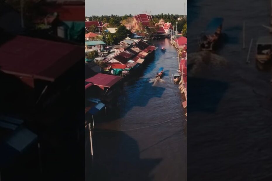
Floating Markets of Thailand

Another Bangkok Thailand travel tip is the Floating markets, and during the years of 1350-1767 became important trading centers. Thailand has an abundance of rivers and canals that crisscross the country. These waterways provided the major transportation link for the local residents during this time. The soils on the banks of the rivers and canals are especially fertile and rich. These banks are the perfect place to grow the many fruits and vegetables that are so abundant in Thailand. Thailand is famous for Malacca grape, Chinese grapefruit, star fruit, mangoes, bananas, and coconuts.

During the years of 1782-1868 these markets were still a major way of connecting the neighboring farmers with the city dwellers of the central part of Thailand. In the late 1800‘s roads and rail networks were constructed in the country. During this time period, people began to prefer to use these roads to go to market. It was then that the riverside markets started to flourish. Many of these have survived till today.

Floating Markets of Thailand
Damnoen Saduak Floating Market

These river communities also resulted in a number of floating markets. The Chao Phraya River Basin became a hub for these popular markets. Today you will find many markets that are mainly for tourists in Bangkok. Floating markets outside the city mainly cater to the local needs of the communities and are smaller.

The floating markets contain stories of people’s lives and have a special charisma. Many of the main markets have been renovated and brought back to life. It is a major part of Thai life that allow today’s generations to see the life of their ancestors in action. Tourists from abroad also flock to these markets. They have become sources of tourist revenue for the local farmers. Usually, you will also find the riverside shops on the banks selling the many products and foods of Thailand.

Selling vegetables along the Damnoen Saduak Floating Market

Thailand is a fascinating Asian country to visit. It is not too early to book your next Asian adventure. While in Bangkok, be sure to visit the floating markets. Pick up some of the beautiful handicrafts found in the Riverside markets, grab some wonderful fruit off the moving boats, and try some native noodle dishes for dinner. For a list of some of the major markets near and in Bangkok, see the link below. You will also find the days and times the markets operate and directions for getting there. Also, check out our website for more Asian destinations.

Damnoen Saduak Floating Market

Damnoen Saduak Floating Market

Damnoen Saduak Floating Market is in Ratchaburi, Thailand. Here you will see the historic and peaceful Thai floating market in it’s unique and authentic atmosphere. There are countless tourist floating markets throughout the country. This one, is unique and authentic. It is a market for the local people, but tourists are welcome. This is a piece of Taiwanese history in live drama. These beautifully  clad merchants make their way through the river as they peddle their fresh fruit and vegetables. Here they sell to others who come to buy in their canoes and to those on the river bank. There is lots of noise as they barter back and forth. It is a fun day you will not want to miss.

Transportation along the Damnoen Saduak Floating Market

Damnoen Saduak Floating Market in Ratchaburi, Thailand is the most famous of all the floating markets in the country. You will need to leave the city to enjoy it, though. It is about 62 miles southwest of Bangkok City. This busy market is at it’s  best in the early morning hours. The locals get up early and go to market before the tourists arrive and the day turns hot. If you want to go to market and enjoy the experience, get up and head out early. In this case, the early bird gets the worm. For information on market tours, check out this website:
http://www.bangkok.com/beyond-the-city/damnoensaduak.htm

While in the area, check out the Phra Pathom Chedi in Nakorn Pathom. It is said to be the largest pagoda in all of Southeast Asia. This is one of the most elaborate temples and monasteries in Thailand and the pagoda is housed inside the temple.

Thailand is just a few hours away. Grab your passport, pack your bag and I’ll see you at the airport. Now is the time to book your next Thailand adventure. Memories of a lifetime are waiting for you In Thailand. Let’s go to the market!

Phra Thinang Chakri Maha Prasat
Phra Thinang Chakri Maha Prasat in Bangkok Thailand

Phra Thinang Chakri Maha Prasat

Phra Thinang Chakri Maha Prasat is one of Thailand’s most beloved landmarks. This should be on every Bangkok itinerary. The architecture and decorations are amazing. The temples in the compound were built over a span of 200 years. The temples are rich in decoration. Many are made of the finest gold. The building of the Royal Palace began in 1782 and was an ongoing project for each succeeding king. Each king that occupied the palace built and rebuilt parts of this compound. Phra Thinang Chakri Maha Prasat is surrounded by tall white stone walls. The complete compound occupies approximately one square mile.

The Phra Maha Monthain Group was built-in the central section of the compound. It was the first of the building groups. Phra Maha Monthain Group was built by King Rama I. He also built his own royal residency which he used until his death. This group was used for the coronation of King Rama I and for all the future coronations of the Chakri Dynastry. Phra Thinang chakri Maha Prasat Group was built by King Rama V. Originally this group consisted of 11 buildings, but only 3 remain today. Borophiman Mansion and Siwalai Garden Group was designed by King Rama III. He had many of the buildings of King Rama II demolished to make space for added temples that were dedicated to his father. He also built a residence where he lived till he died.

Each building in this compound has a story. It is the never-ending saga of the kings of the Chakri Dynasty. It is the heritage of Thailand.  The architecture is extremely unique and captivates the imagination. Each king added to the work of the former king. One of the buildings is even done in a modern European style. King Rama VIII lived there until 1945.

Wat Arun Temple of Dawn

Wat Arun- Temple of Dawn is a well-known Khmer style Buddhist Temple in Bangkok, Thailand. Wat Arun gets it’s name  from the Hindu god of the dawn, Aruna. This famous landmark is located on the west bank of the Chao Phraya River in Bangkok. Perhaps it is best known for its massive tower, called a prang. The prang, with a height of more than 262 feet, is built in the Khmer architectural style. This beautiful prang is a symbol of the legendary Mount Meru, considered to be the center of the known universe. It is the tallest tower in Thailand. Wat Arun is one of 6 Royal temples in Thailand and is deeply revered.

Temple of dawn unique architecture and art.

Wat Arun was  1782 and predates the building of Bangkok. For many years this impressive temple dominated the river bank of Bangkok. Wat Arun stands directly across the river from the Grand Palace. The Grand Palace was the center of a former government and was the focal point for the building of the city of Bangkok.

Temple of dawn unique architecture and art.
Exploring the temple of dawn in Bangkok Thailand.

Wat Arun is maybe best known by its prang or tower. This Khmer style tower is decorated with millions of small pieces of colorful Chinese porcelain and beautiful seashells. There is a very steep stairway on the side of the tower leading to two terraces. If you can muster the energy, this is a must climb. From these terraces is perhaps some of the greatest views of the City of Bangkok, the river, and all the surrounding countryside. In addition to this main prang, are four small satellite prangs.These smaller prangs are dedicated to the wind god, Phra Phai. There are many other statues of gods, pagodas, Chinese statues, and other holy artifacts. This temple is one of the most impressive buildings in Thailand and perhaps the world.

Chinese stone guardian at the Temple of Dawn Wat Arun

No trip to Thailand is complete without a visit to Wat Arun. Wat Arun is open daily from 8 am to 5:30 pm. Speed boats are available from the city side of the river to take you across. It is also accessible by city bus and taxi.  Is this the year for your Thailand Adventure? Check out the links below and plan to visit Thailand, an amazing country, with amazing architecture, awesome wildlife, and friendly people.

The Ananta Samakhom Throne Hall in Bangkok, Thailand

Ananta Samakhom Throne Hall

Ananta Samakhom Throne Hall is perhaps one of the world’s uniquely and architecturally beautiful buildings. The fabulous  renaissance architectural design is out of this world. It is amazing and wonderful!  The Ananta Samakhom Throne Hall is a former reception hall within Dusit Palace in Bangkok, Thailand. What an awesome reception hall this must have been. Can you imagine being one of the royal invited guests?  It is currently being used as a museum and on occasion it hosts special State events for the government of Bangkok, Thailand. What awesome splendor!

In 1906 King Chulalongkorn, who was Rama the V, commissioned the construction of Ananta Samakhom Throne Hall. This fantastic reception hall was carefully designed to replace the one that had been built by King Mongkut, who was Rama IV. This beautiful reception hall is now over 100 years old and is still as graceful and exquisite as it ever was. Ananta Samakhom Throne Hall is a two storey construction with a large dome in the centre. It is  surrounded by six smaller domes. Unfortunately, King Chulalongkorn died in 1910 never having seen the completion of the beautiful Throne Hall. Ananta Samakhom Throne Hall was completed in 1915 and must be by far one of the grandest building in Thailand.

Ananta Samakhom Throne Hall is a royal building and visitors are welcome. There is a very strict dress code that must be followed to enter the royal hall. Men must have trousers and sleeved shirts and women must have long skirts and sleeved shirts. Women in trousers are not considered appropriately dressed. No mini skirts, shorts, sleeveless shirts, jeans, or ripped pants are allowed. If needed, Sarongs may be purchased and there are lockers for cameras and mobile phones. No electronics of any kind are allowed in the Throne Hall. Even if you have paid for entry into the Dusit Gardens, there is a separate entry fee charged to view the Throne Hall.  Recordings are available in several languages to guide you through the Throne Hall.

Make this the year you visit Bangkok, Thailand. It is beautiful! Plan to spend at least 4 hours in Dusit Garden. Remember to come dressed correctly if you want to view the Ananta Samakhom Throne Hall. For further information see the websites below.

Wat saket
Wat Saket Ratcha Wora Maha Wihan, known as the Golden Mountain in Bangkok Thailand

Wat Saket Golden Mountain

Wat Saket, is commonly known as The  Golden Mountain. This unique temple sits on a hill in the heart of Bangkok. It is in easy walking distance from the Grand Palace.  Each year during the month of November, Wat Saket is host to a sacred pilgrimage. During the pilgrimage, the villagers begin the climb to the top of the hill at an unusual cemetery and then climb the 300 steps to the top.

Wat Saket is the place for a good view and deep spiritual solitude. The golden mount is one of the famous temples in Thailand. It was built in the early 1800s. The temple was later refurbished. Here you will gain a fresh view of Bangkok. Wat Saket is a fascinating place with a magnificent view of the city below. Each time you visit Wat Saket, you see something new and different. You leave with a whole new perspective on Thailand.

What a panoramic view there is from The Golden Mountain. Bangkok buildings have such equiset roofs. When on the mount, you get a view of many unique roofs and the greater Bangkok City.  Looking out from the grounds the city seems almost perfect. You can marvel how the old and the new blend. On normal days, the grounds of the temple is extremely quiet and one can hear the chanting of the monks. As you look across the grounds you will see many mature trees featured and many Buddhist monuments.

The temple is open year around to worshipers and the Chedi on the Mountain is home to a Buddhist  relic. Please remember to be quiet and respectful as you spend time at Wat Saket. It is an active place of worship for those who follow the Buddha.  In addition to the many outside places to worship and the Chedi on the hill it has all the typical buildings. Within the compound there is a main chapel, an Ordination Hall and a Library. To get to the top worships need to  climb over 300 steps. The walls  circle the chedi  almost like a snake. As you near the top, you will begin to see bells that ring out regularly.

Wat Saket can be accessed easiest by water ferry or taxi boat.  Go to the last stop and then walk for about 10-15 minutes. Outside the entrance, you will find food vendors. They are great if you desire a small snack or a bowl of soup.  The walk up the hill could be challenging for some. It is well worth it. The atmosphere is peaceful and it is by far the best view of the city. So on your next Thailand vacation, be sure to spend some time at Wat Saket. You will be rewarded with the view of the century.

Thailands Magnificent Elephants And Their Mahout

Thailand's Magnificent Elephants
Elephant and his mahout in Thailand

Thailands Magnificent Elephants are a wonder to watch. Wild elephants in Thailand are especially hard to count. The elephant lives in the dense bamboo forests. It is here that they can find a steady diet of grasses, bark, and bamboo. Bamboo is perhaps their favorite culinary dish! They also have a great love for a good banana on the side. A mature adult elephant eats up to 400 pounds of vegetation a day. Most experts in the field estimate that there are between 2,000 and 3,000 wild elephants. There is  about the same number of domesticated elephants in the country.

Thailands Magnificent Elephants in the wild establish tight relationships between themselves and other members of the herd. A calf is raised by all the females in the herd. Like their cousins in the wild, a domesticated elephant establishes a deep and personal bond with his or her trainer. An elephant trainer is called a mahout.  Most trainers raise their elephants from the time they are born. The bond between a trainer and his elephant is priceless. Like all things touched by humans, there have been cases of animal abuse.  Abused animals are not as common as once believed.

Elephants have been of major importance to Asians for thousands of years. They are used for transportation, tourism, and religious festivals. In the past they were used for logging activities. Logging has been banned in most countries of Asia for many years. During religious festivals of every type, elephants play a role. Currently Chabad used an elephant to carry the menorah through the city streets of Bangkok. See the link below.

Riding Elephants and support for the elephant reserve
Riding Elephants and support for the elephant reserve.

Working elephants in the hands of a kind and thoughtful trainer are no different from a working dog or llama in the hands of a good and kind farmer. Many preserves use their elephants for taking tourists out on jungle treks. Tourists attend a class on the proper way to ride and care for an elephant. At the close of the article there will be links for joining one of these jungle adventures.

Thailands Magnificent Elephants are a wonder to see. Take time out this year for the adventure of a lifetime. Learn about this magnificent animal and how to care for him correctly. Go on a planned jungle trek with a knowledgeable mahout. Grab your passport and make your plans today. See you in Thailand in.

Make this the year you visit Bangkok, Thailand. It is beautiful! Plan to spend at least 4 hours in Dusit Garden. Remember to come dressed correctly if you want to view the Ananta Samakhom Throne Hall. For further information see the websites below.

Thailand's dense Bamboo jungles filled with beautiful exotic flora
Thailand’s dense Bamboo jungles filled with beautiful exotic flora

This Bangkok Thailand travel and guide is meant to be free of charge to the general public. Re-publishing is allowed if a link back to this original article.

So pack your bags and grab your passport for the adventure of a lifetime, at Bangkok’s Grand Palace. For more information and other fantastic Asian tourist delights, check out our web site:


Filed Under: Anthropology, Archeology, Asia, Bangkok, education, Food Travel, history, Thailand, travel the world, Travel Tips Tagged With: Bangkok, bangkok tourism, Bangkok's Grand Palace, food travel, lotus root dish, Thailand, Thailand's heritage, The Grand Palace Bangkok

The Magnificent Church Of The Holy Sepulcher In Jerusalem Israel

May 17, 2019 by Exploretraveler.com Leave a Comment

Church Of The Holy Sepulcher

 Light Shines In The Darkness At The Church Of The Holy Sepulcher In Jerusalem Israel

What a magnificent sight to see with light shining into the dark church at the very location of the crucifixion of Jesus, The interior of the church is very poorly lite, but coming into the dome were broad rays of light. It is here that His death, burial, and resurrection took place. The church is designed and built over the crucifixion site and the place of His burial and resurrection.  The Church Of The Holy Sepulcher site has been recognized since early in the 4th century as the place where Jesus was crucified, buried, and rose from the dead. It is believed that it was here that the Light pierced the darkness.

As a traveler, one can not help but notice the amazing difference in the lighting. It brings you back to that time when the light indeed pierced the darkness. If you are a traveler interested in the local history or culture of the area, or a pilgrim wanting to experience contact with the light, this is a must-see while in Jerusalem.

 “And the light shines in the darkness, and the darkness did not comprehend it.”

(KJV John 1:5)

Church Of The Holy Sepulcher

The Inner Beauty Of The Dome

The Church of the Holy Sepulcher is also known among the Eastern Orthodox Believers as the Church of the Resurrection. The Church of the Holy Sepulchre is one of several historical churches within the Christian Quarter. This is a major landmark located  inside the walled Old City of Jerusalem.  This beautiful building, can be found in the Christian sector of the Old City and is a valuable addition to your itinerary. Christian pilgrims around the world consider it one of the holiest places on earth. The building was built so as to include both Golgotha, the place where Jesus was crucified, and the sepulcher where He was buried and rose again from the dead. This has been a very important destination for the faithful dating clear back to the 4th century. What a marvelous site to behold, one that includes both the cross of His crucifixion and the tomb of His burial.

The dome is beautifully done with many paintings from the eighteen hundreds and some from earlier restorations. It is considered the greatest collection of twelfth-century Crusader artwork in the Middle East. It is generally considered an important destination for visitors to Israel and those who are interested in Middle Eastern art, history, and faith. The spectacular workmanship represents many different renovations. This Basilica was destroyed and rebuilt so many times throughout history. Each time it was rebuilt, some of the antiquities from the preceding church were used in the newer renovation or construction.

Another thing to remember is that it has not always been smooth sailing for this extraordinary church. “Subsequent centuries were not altogether kind to the Church of the Holy Sepulchre. It suffered from damage, desecration, and neglect, and attempts at repair (a significant renovation was conducted by the Franciscans in 1555) often did more damage than good. In recent times, a fire (1808) and an earthquake (1927) did extensive damage.

Not until 1959 did the three major communities (Latins, Greeks, Armenians) agree on a major renovation plan. The guiding principle was that only elements incapable of fulfilling their structural function would be replaced.

The exterior facade of the Church of the Holy Sepulchre, on the east side of the church, was built by the Crusaders sometime before 1180.” (Taken from: http://justfunfacts.com/interesting-facts-about-the-church-of-the-holy-sepulchre/)

Church Of The Holy Sepulcher

The Holy Basilica Dome Showing The Nitches And Amazing Detail

This spectacular dome not only is full of artistic touches, but it acclaimed to be at the very center of the earth.

“Pilgrims and Crusaders believed the site to be the literal center of the earth, based on various biblical references.  In Crusader times the actual centre point was determined as the triporticus area, later the domed crossing of the Crusader Church of the Holy Sepulchre.  Visitors to the church can then be said to be “at the naval, or centrepoint, of the earth.” ( The Art of one of Christendom’s Holiest Sites by John Stringer)

Church Of The Holy Sepulcher

Another View Of This Elaborate Dome

Notice all the carved niches and the hanging gold incense holders. The Church of the Holy Sepulcher has some of the most ornate fixtures of any basilica in the East. Pictures of saints and holy men line the walls. The lamps and ornamental additions to the dome are all solid gold. Throughout the dome and elsewhere in The Church of the Holy Sepulcher you will find some of the finest art of the Crusader era.

The Church Of The Holy Sepulchre is believed to be the location of the empty burial tomb of Jesus. This is considered by many to be the holiest Christian site in Jerusalem. The Church of the Holy Sepulcher is considered to have one of the largest collections of 12th Century Art done by the Crusaders in the Middle East. Tourists, travelers, and pilgrims consider this a must see for all who show interest in historical art and faith. Much of the history of the area and warfare over the centuries, is depicted in various pieces of artwork.

Church Of The Holy Sepulcher

 A Priest Administers The Sacred Incense

The Church Of The Holy Sepulcher is a continued place of meditation and prayer, day and night. Pilgrims come from the world over for the opportunity to pray and experience deep meditation at this Holy site. Priests keep a thick smoke from the incense coming from the altar day and night. This is one of the holiest  sites for so many pilgrims the world over.

The use of incense dates back to the time of the second temple and the Jewish use of incense. It is thought by many that it represents the prayers of the faithful ascending to heaven.  Incense is also used in rites of purification within the Catholic, Eastern, and Orthodox Churches.

Taking a walk through this Basilica requires careful movement among the many pilgrims. At many times of the year, the pilgrims are almost wall to wall. As you near the altar, the thick incense drifts through the air from the gentle movement of the incense vessels by the priest. The Church Of The Holy Sepulcher is one of the most amazing experiences in the Old City of Jerusalem.  The old city is also referred to as the walled city, because of the walls which surrounded this ancient city.

Church Of The Holy Sepulcher

 Climbing The Steps To Calvary

Once this was a hill you climbed, but now it is a protected site. As you climb the stone steps that lead to the top where Jesus was crucified, you can not help but be in a somber mood. Crucifixion was a brutal way to die. According to accounts in all the Gospels of the New Testament, Jesus was brought to the “Place of the Skull” to die by Crucifixion. He was crucified between two thieves, criminals, but his only charge was claiming to be the “King of the Jews.”

This climb up to Calvary is on the major route for Christian pilgrims of many faiths. The Church Of The Holy Sepulcher is the Holiest site in the Old City of Jerusalem. The church protects both the place of the Crucifixion and the place of the resurrection.

Church Of The Holy Sepulcher

Nail Driven Through The Ankle Bone Discovered In Jerusalem From The 1st Century A.D. 

This discovery brings to the pilgrim’s mind and emotions all the horror of the crucifixion. You can not help but feel the pain and agony as you look at this nail through an ankle bone. Crucifixion was the most humiliating of all possible executions. The condemned person was made to be as vulnerable as could be, and usually, they were hung totally naked. Sometimes they could even hang for days just barely alive. This must have been one of the world’s worst form of execution.

In the Forbes Magazine, December 8th, 2015 issue, Khristina Killgrove gives a glance into the significance of this find. She writes: “The Romans practiced crucifixion – literally, “fixed to a cross” – for nearly a millennium. It was a public, painful, and slow form of execution, and used as a way to deter future crimes and humiliate the dying person. Since it was done to thousands of people and involved nails, you’d probably assume we have skeletal evidence of crucifixion.  But there’s only one, single bony example of Roman crucifixion, and even that is still heavily debated by experts.”

Church Of The Holy Sepulcher

The Rock Of Golgotha Where Jesus Was Crucified 

The rock of Golgotha is believed to be the very place where Jesus Christ was crucified. This place is now protected as a part of the Church of the Holy Sepulcher in the Old City of Jerusalem, Israel. This holy site is venerated as Golgotha, also called the Hill of Calvary, is the place where Jesus was crucified with a thief on each side. The Church of the Holy Sepulcher is also believed by most archaeologists as the place where Jesus was buried in the Sepulcher. According to the biblical accounts, the crucifixion site and the place of his tomb were close.

                                                    JOHN 19:41-42

“41 Now in the place where he was crucified there was a garden; and in the garden a new sepulchre, wherein was never man yet laid.

42 There laid they Jesus therefore because of the Jews’ preparation day; for the sepulchre was nigh at hand.”

Though there is some controversy about this site, the Encyclopaedia Britannica has an interesting way of putting some of the pieces together.

“This site has been continuously recognized since the 4th century as the place where Jesus died, was buried, and rose from the dead. Indeed, the Rock of Calvary, where the Crucifixion is believed to have occurred, is encased in glass at the lavish Altar of the Crucifixion and is the most-visited area within the church. Whether it is the actual location, however, has been hotly debated. It cannot be determined that Christians during the first three centuries CE could or did preserve an authentic tradition as to where these events occurred. Members of the Christian church in Jerusalem fled to Pella about 66 CE, and Jerusalem was destroyed in 70 CE. Wars, destruction, and confusion during the following centuries possibly prevented preservation of exact information. Another question involves the course of the second north wall of ancient Jerusalem. Some archaeological remains on the east and south sides of the Church of the Holy Sepulchre are widely interpreted to mark the course of the second wall. If so, the site of the church lay just outside the city wall in the time of Jesus, and this could be the actual place of his Crucifixion and burial. No rival site is supported by any real evidence.” (Encyclopaedia Britannica)

Church Of The Holy Sepulcher

The Stone Of anointing

The Stone of Anointing was the stone where the body of Jesus was laid after being removed from the crucifix and it was here that his body was prepared for burial. This is another one of the holy sites at the Church of the Holy Sepulcher in Jerusalem, Israel. As was the Jewish custom of the time, he was anointed with oils and spices, then he was wrapped in shrouds. This was the common way that all bodies were prepared for burial during this time by the Jews.

“The Stone of the Anointing remains a very holy pilgrimage site for Christians today. Pilgrims queue to either kiss the stone or rub it with oil or rosewater and then wipe it with a cloth. Priests burn incense around the stone and sometimes people place their own crosses on it in order to transfer the unction or anointing.”( History of the The Stone of the Anointing is taken from the website: (https://www.thesalvationgarden.org/the-stone-of-the-anointing/.)”

“Rosewater is used to anoint the Stone of the Anointing because it is a perfume that has traditional use in a number of religions. For example, during Muslim burials rosewater is sprinkled into a grave before burial. Rosewater has in the past been used for the embalming of bodies as it has properties that are good for the skin.”( History of the The Stone of the Anointing is taken from the website: https://www.thesalvationgarden.org/the-stone-of-the-anointing/.)”

“Over hundreds of years, there have been stories of miracles and cures experienced by people who have visited and anointed the Stone of the Anointing. The atmosphere in the Church of the Sepulchre is one of reverence and worship. This is clearly one of the holiest places and somewhere that each and every one of us should consider visiting during our lifetimes.” ( History of the The Stone of the Anointing is taken from the website: https://www.thesalvationgarden.org/the-stone-of-the-anointing/.)”

Church Of The Holy Sepulcher

Syrian Orthodox Chapel In The Church Of The Holy Sepulcher

The Syrian Orthodox Chapel of the Jacobite sect is located just behind the tomb where Jesus was buried. Due to the poverty of the Syrian Orthodox Church, little repairs or restoration has been done to the chapel area. The chapel is located within the church walls of the Constantine Church, all of which are a part of the Church of the Holy Sepulcher in Jerusalem today. The walls and altar sustained major fire damage over the years and no repairs have been made. To the south of the chapel, you will find many typical Jewish tombs of the 1st century. According to tradition, the tombs of Joseph of Arimathea and Nicodemus are found in this area. It was Arimathea who took down the body of Jesus from the cross and saw to the proper burial.

                             “Luke 23:50-56 King James Version (KJV)

50 And, behold, there was a man named Joseph, a counselor; and he was a good man, and a just:

51 (The same had not consented to the counsel and deed of them;) he was of Arimathaea, a city of the Jews: who also himself waited for the kingdom of God.

52 This man went unto Pilate and begged the body of Jesus.

53 And he took it down, and wrapped it in linen, and laid it in a sepulcher that was hewn in stone, wherein never man before was laid.

54 And that day was the preparation, and the sabbath drew on.

55 And the women also, which came with him from Galilee, followed after, and beheld the sepulcher, and how his body was laid.

56 And they returned, and prepared spices and ointments, and rested the sabbath day according to the commandment.” 

footprint of jesus

Church Of The Holy Sepulcher

Interior Of The Tomb Of Joseph Of Arimathea

Inside the Syrian Orthodox Chapel of Saint Joseph of Arimathea and Saint Nicodemus is a very plain rock hewed cave where Jesus was laid to rest. It is here that the women returned on the First Day of the week to find Jesus was not where he had been placed. Instead, the rock which covered the entrance was rolled aside and Jesus was no longer there.

                         “Matthew 28:1-7 King James Version (KJV)

28 At the end of the Sabbath, as it began to dawn toward the first day of the week, came Mary Magdalene and the other Mary to see the sepulcher.

2 And, behold, there was a great earthquake: for the angel of the Lord descended from heaven, and came and rolled back the stone from the door, and sat upon it.

3 His countenance was like lightning, and his raiment white as snow:

4 And for fear of him, the keepers did shake and became as dead men.

5 And the angel answered and said unto the women, Fear not ye: for I know that ye seek Jesus, which was crucified.

6 He is not here: for he is risen, as he said. Come, see the place where the Lord lay.

7 And go quickly, and tell his disciples that he has risen from the dead; and, behold, he goeth before you into Galilee; there shall ye see him: lo, I have told you.” (1. Matthew 28: 1-7 KJV)

The National Geographic Magazine October 31, 2016 issue in the article: “Unsealing of Christ’s Reputed Tomb Turns Up New Revelations” by Kristin Romey gives fresh insight into the condition of the tomb today.

“JERUSALEM Researchers have continued their investigation into the site where the body of Jesus Christ is traditionally believed to have been buried, and their preliminary findings appear to confirm that portions of the tomb are still present today, having survived centuries of damage, destruction, and reconstruction of the surrounding Church of the Holy Sepulchre in Jerusalem’s Old City.

The most venerated site in the Christian world, the tomb today consists of a limestone shelf or burial bed that was hewn from the wall of a cave. Since at least 1555, and most likely centuries earlier, the burial bed has been covered in marble cladding, allegedly to prevent eager pilgrims from removing bits of the original rock as souvenirs.

When the marble cladding was first removed on the night of October 26, an initial inspection by the conservation team from the National Technical University of Athens showed only a layer of fill material underneath. However, as researchers continued their nonstop work over the course of 60 hours, another marble slab with a cross carved into its surface was exposed. By the night of October 28, just hours before the tomb was to be resealed, the original limestone burial bed was revealed intact.”

Church Of The Holy Sepulcher

Scaffolding On A Large Unmarked Wall

Possibly a large stone is contained in the scaffolding on this large unmarked wall that might have been part of an earlier altar. This may have been a part of an archaeology project headed by the Greek Orthodox, under whose control that section of the building remains. Any work, that might have been done, seems to have halted. This project possibly dates back into the 1960s, when there was a major project started that was never completed.

There are often unknown digs that go on in different areas of the Church of the Holy Sepulcher due to the shared status of the building and the distrust that can sometimes be seen. The Greek Orthodox, Roman Catholics, Coptic’s, Syrians, and Armenians, all share guardianship of this beautiful piece of history. The Ethiopians have a monastery on the roof and control that area. Two Muslim families keep the keys to the massive Crusader doors. This enables all to have complete access when desired.

Church Of The Holy Sepulcher

The Ladder Window

The mystery of the Ladder Window is one that is centuries old. In fact, the ladder has been there so long, that people no longer even know how it got there or what it was used for. Over the centuries there have been many suggestions put forth, but all are just an attempt to solve an unsolvable mystery.

One that many people have offered is that it was left behind by a careless mason, or window washer. With a building of this size, that certainly is a very real possibility. But then, there is the suggestion of it having been used in order to supply food to the Armenian monks who were locked in the church by the Turks. No matter the reason for the original ladder, it did come in handy for the monks wishing to use the cornice as a balcony to get fresh air and sunshine. By not leaving the church, they were able to bypass paying the Ottoman tax to re-enter through the door.

The ladder appears in an engraving of the church that was done in 1728 and is mentioned in the work of Sultan Abdul Hamid I in 1757. No matter when it was originally left in that position, it is immovable and it is part of the Status Quo. It must permanently remain in its position on the ledge over the entrance to the Church of the Holy Sepulcher. Regardless of when the original ladder was left in this position, it is impossible to think that this is the original ladder that was left behind.  Being that it has weathered the elements of Mother Nature since the early 18th century, it would have had to have been replaced at least once. The ladder, window,  and the historical cornice are all included as part of the possession of the Armenian Orthodox Church and must so remain.

Church Of The Holy Sepulcher

The Magnificent Church Of The Holy Sepulcher In Jerusalem Israel

Any time of the year is the perfect time to visit the Holy Land. There is always more to see and do than the time you have. If you enjoy history, you will enjoy all the museums and archaeological sites. There is a vast number of ruins to explore and conquer. A trip to Israel also pairs nicely with a side trip to Jordan. You can easily spend a whole day discovering Petra.

For the Christian believer, the highlight of a spring trip would be to join in with the local Christian Churches as they celebrate the Resurrection Of Jesus. Information on the events being held during Holy Week can be found by calling a local Cathedral. The Church of the Holy Sepulcher is very involved in the different Holy Week events. Each of the many denominations, your travel guide, and even your motel can suggest many places to go during this special week.

Those of the Jewish faith will delight in the events surrounding the Passover. A quick call to any of the Chabad Houses will give you all the information needed. Chabad also has a special seder service throughout the Holy Land for those who are traveling, and lack local contacts.

Regardless of your reason or interests, there is never a moment without something to see or do.  Jerusalem is an amazing city that you will want to spend as much time as possible. Why not make this the year, you celebrate the events surrounding Easter or Passover in the holy city of Jerusalem, Israel?

                                               GENERAL INFORMATION

Special Holy Week Events


“Palm Sunday procession on the Mount of Olives

Join the popular reenactment of Jesus’ Triumphal Entry into Jerusalem. Participants gather at the Church of Bethpage and begin at 2:30 pm to descend the Mount of Olives, singing hymns and bearing palm fronds.

The Church of the Holy Sepulchre

The Armenians, Copts and Syrians make three rounds around the rotunda in the Church of the Holy Sepulchre. The Palm Procession starts at 7:00 am, and the daily procession begins at 5:00 pm.” (The Official Jerusalem Travel Site)
Holy Thursday Events

“The washing of the feet is a tradition in imitation of Jesus washing his disciples’ feet.

Church of the Holy Sepulchre

8:00 am — Pontifical Mass (Supper of the Lord & Mass of the Chrism), Procession of the Blessed Sacrament

In and around the Old City

3:10 pm — Pilgrimage from St. Savior’s Church (from the entrance from St. Francis Street) to the Cenacle, St. James and St. Mark followed by service with the Washing of the Feet

9:00 pm — Holy Hour in different languages at the Garden of Gethsemane on the Mount of Olives followed by private prayer in silence.” (The Official Jerusalem Travel Site)

Good Friday
“7:15 am — Celebration of the Passion of Christ on Calvary in the Basilica of the Holy Sepulchre

12:15 pm — Procession of the Way of the Cross at the Via Dolorosa with the Franciscan Fathers

8:10 pm — “Funeral Procession” in the Basilica of the Holy Sepulchre

The Garden Tomb

For Protestants, there is a Good Friday meditative service (English) at the Garden Tomb.”

Holy Saturday

The Church of the Holy Sepulcher

6:30 am — Easter Vigil

3:30 pm: Entry and solemn procession

6:00 pm — Solemn Vespers the Holy Tomb

11:30 am (Sunday) — Pontifical celebration of the Liturgy of the Hours at the Altar of Mary Magdalene, presided by the Custos of the Holy Land

Late Saturday night is the Holy Fire ceremony. Thousands await the miraculous lighting of the Patriarch’s candle from within the tomb. Caution is advised since the crowds tend to be tight and there has been violence in recent years.” (The Official Jerusalem Travel Site)

The Church of the Holy Sepulchre Easter Service

10:00 am — Entry of the Latin Patriarch, H.B. Fuad Twal

10:30 am — Pontifical mass and procession

5:00 pm — Daily Procession

The Garden Tomb

Sunrise services in English
Resurrection service in English

8:00 am — Jerusalem Holy Sepulcher: Daily Solemn Mass

10:00 am — Emmaus Qubeibeh: Pontifical Mass & Blessing of bread presided by the Custos

2:30 pm — Emmaus Qubeibeh: Vespers & Exposition of the Blessed Sacrament

5:00 pm — Jerusalem Holy Sepulcher: Daily Procession

MORE SERVICES AND EVENTS

Get the complete schedule for Easter services at both Catholic and Protestant institutions throughout the city by visiting the Christian Information Website.” (The Official Jerusalem Travel Site)

                                             Directions And Information

The Church of the Holy Sepulchre is located in East Jerusalem in between the Jaffa Gate and the Damascus Gate.

Telephone……02/ 627-3314

Visiting Hours: Winter hours

: 4:00 AM – 7:00 PM, Summer hours are: 4:00 AM – 8:00 PM.

Church Of The Holy Sepulcher

References:

  1. King James Bible
  2. The Art of one of Christendom’s Holiest Sites by John Stringer
  3. Forbes Magazine, December 8th, 2015 issue.”This Bone Is The Only skeletal Evidence For Crucifixion In The Ancient World “by Khristina Killgrove.
  4. Encyclopaedia Britannica, “The Church of the Holy Sepulchre “
  5. History of the The Stone of the Anointing is taken from the website: https://www.thesalvationgarden.org/the-stone-of-the-anointing/.
  6. http://justfunfacts.com/interesting-facts-about-the-church-of-the-holy-sepulchre/
  7. The National Geographic Magazine October 31, 2016 issue in the article: “Unsealing of Christ’s Reputed Tomb Turns Up New Revelations” by Kristin Romey
  8. The Official Jerusalem Travel Site  —– https://www.itraveljerusalem.com/article/easter-in-jerusalem/

https://exploretraveler.com/church-saint-john-baptist-birth-place-john-baptist/

https://exploretraveler.com/garden-gethsemane-treasures/

Filed Under: Asia, Israel, Jerusalem, nazzarth, travel the world, Travel Tips, World Travel Tagged With: Church of the Holy Sepulcher, crucifixion of Jesus, Easter in the Holy Land, Israel, Israel Museum in Jerusalem, Jerusalem, Nazzarth, Passover in the Holy Land, The Church Of The Holy Sepulcher, The Rock Of Golgotha, The Stone Of anointing, The Syrian Orthodox Chapel, Tomb Of Joseph Of Arimathea

Mangoes: Baby Green Mangoes From Taiwan

April 30, 2019 by Exploretraveler.com Leave a Comment

Baby Green Mangoes
Baby Green Mangoes

Mangoes: Baby Green Mangoes From Taiwan

Mangoes are a special treat from the tropics.  The Baby Green Mango is special and makes an awesome snack. There are over 1,000 different varieties of Mango and they are all alkaline in the body. They are one of the power foods of the tropics! They are delicious! One cup of mango chunks provides over 76% of the daily vitamin C requirement for the body and is a great immune booster.  It provides 26% of the daily vitamin A requirement. It is a powerful antioxidant and has enzymes that protect the red blood cells. It has both potassium and magnesium, which help to balance out the salt intake in the body. These humble fruits are one of the most important super fruits that come to us from Southeast Asia and India. One of the many delightful varieties is the small Baby Green Mangoes produced in Taiwan.

Baby Green Mangoes were brought to Taiwan by the Dutch in the early 16th century. They quickly became a favorite and are often processed into snacks which the Taiwanese love.  They are also used for juicing, in salads, and soups.   Unripe and extremely sour mangoes are desirable, as most households prepare mango pickles which last for more than a year. Ripe mangoes are also highly valued due to their sweet taste. They are eaten after meals or in the evenings. Mangoes are a favorite dessert in Taiwan. Here are two Taiwan favorites for using small green mangoes.

MANGO PICKLE RECIPE

1: Rinse and wipe the mangoes well with a kitchen towel. chop the mangoes and add them in a bowl.

2: Add (I usually get the spices at the small Indian Market. The English name is first and the Indian name follows.)

  • fenugreek seeds/methi
  • fennel seeds/saunf
  • mustard seeds/sarson (optional)
  • nigella seeds/kalonji
  • salt

3: Coat the mango chunks evenly with the spices in a bowl and cover with cheesecloth. Leave 3-4 days in the sun. If cloudy you may need 5-6 days.

4: When the mango and the spices are well-integrated, put in a clean jar and fill to one inch above the fruit with mustard oil. If you like your pickles spicy, use room temperature. If you prefer milder pickles, heat the oil and then pour over the mango and spices. The mango pickles will keep for up to a year without refrigeration, however, they never last that long.


TROPICAL RED LENTIL AND RAW GREEN MANGO SOUP

Ingredients
1.5 cups red lentils
1 raw green mango chopped
1 cup coconut milk ( Most like to use 2 cups)
1 large carrot chopped
2 celery sticks chopped
1/2 onion chopped
2 cloves garlic minced
a small piece of ginger minced
1 tsp cumin powder
1 tsp red cayenne pepper
touch of turmeric
salt to taste
some chopped cilantro to garnish
some coconut flakes to garnish
1-2 tbsp oil
4-5 cups of broth or water

Heat a large pot or dutch oven. Add oil and onions, garlic and ginger. Fry lightly for 5 minutes until the onions are translucent. Add chopped mangoes, carrots and celery and fry lightly for another minute or two. Add coconut milk, 4-5 cups of  broth or water, turmeric, cumin, salt and cayenne pepper and bring to a boil. Add the lentils. Reduce flame, cover and simmer for 30-40 minutes, or until lentils are done. Garnish with some chopped cilantro, coconut flakes and a dash of cayenne pepper. Serve warm. (Recipe comes from  Fly N Cook Vegetarian Soups)

This is a fantastic soup for a cold winter day. Enjoy a touch of the tropic today! It is delicious! Next time you are in Taiwan sample all the many soups, salads, and snacks that begin with the Baby Green Mango. For more ideas on using the mango check out the government mango page at http://www.taiwan.gov.tw/cht/action/mango/eng/mango/mango06.html

Exploretraveler.com

Enjoy Your Baby Green Mangoes Today!

Filed Under: Asia, East Coast Taiwan, Food Travel, Green Island, Hsin-Chu, Taipei, Taitung, Taiwan, World Travel Tagged With: alkaline fruit, antioxidant, Baby Green Mangoes, MANGO PICKLE RECIPE, Mangoes, Super food, TROPICAL RED LENTIL AND RAW GREEN MANGO SOUP

US China Education Comparison

April 16, 2019 by ExploreTraveler Leave a Comment

Comparative Essay

Education, Economic Growth, and Success

China and the United States

By

John J Gentry

US China Education Comparison

US China Education Comparison

The US-China Education Comparison and China growing economically and investing all around the world; they will become a major leader alongside the  United States and the European Union. Current American attitudes with education and teamwork create a disadvantage in regards to China. China for better or worse will have a central planning authority and stable leadership since their constitution has been modified to keep the current leadership for the rest of his life. One must also think long and hard about China as a culture and how the Chinese family unit works as a whole with the goal of lifting each next generation to the next level of education and excellence. The family culture within the United States is being diminished at the same time the Chinese are solidifying the family unit for the purpose of moving these next generations forward. This concept can be hard for Americans who have bought into doing it alone attitude but we must understand why we are falling behind the world educationally so we can make an effort to improve. The United States must reform it’s secondary education system to include a structured college based system for juniors and senior high school students. (Segal, 2011)

US China education comparison

Social differences between the two countries can be difficult for the average person to understand but they can be understood and broken down. First, we have to focus on the long-standing history of the Chinese and how they view their own history. China has had wars and many changes in leadership over thousands of years but the Chinese people always moved forward. China has been invaded and sometimes controlled via foreign powers but the Chinese people have always endured. China has gone through world war one, world war two, and the communist revolution and the Chinese peoples kept moving forward. Through famines, droughts and forced one child policies the culture of the Chinese people is still intact and very strong. This is the only culture in the world to have continuity over such a long period of time. However, this constant stability of family, village and regional support has always expected the next generation to build upon the last and this does show up in their massive growth. But with this style of expectations thrust upon each new generation, there is a certain spirit of innovation that can be lost. Chinese children are not for the most part allowed to spend time outside of studies and their continued education. So they begin to miss certain hands-on skills in everyday life. This difference can give them a disadvantage with troubleshooting and critical thinking tasks. Also being efficient with the use of their time can take a backseat due to saving face and showing respect to leadership and elders. With Chinese parents highly focused on economic enhancement for their family and country, most students will bypass as much education in the humanities altogether. Now there are some recent exceptions with some parents starting to include music and classical music into early childhood due to research that some parents think can enhance a child’s ability to perform in the math and sciences. As Nussbaum explains in regards to India but also applies here in regards to China; a lack of humanities can leave education less fulfilling and leave out the ability to develop critical thinking skills. (Nussbaum, 2010) When looking into the US China Education Comparison along these line we can clearly conclude the differences.

US China education comparison

In the United States, we have strong university systems and encourage innovation, self-starters, imagination and critical thinking skills.  However, during that last few decades, these same universities now have grown more political and center around certain politically correct norms. Thus isolating or pushing out students who don’t fit into that universities current political mindset or pre-setup economic conditioned model. (Nussbaum, 2010) This loss of balance is hurting our innovation and also encouraging foreign scientists to consider going back home where their own political ideas may be more accepted. Innovation requires the inclusion of people from multiple walks of life and with social differences becoming a political firestorm on university campuses we have the risk of pushing talent out of the country. Graduate level degree-seeking students should be able to have more interdisciplinary approaches without being excluded or looked down upon within academia as not specialized enough. Areas of study that combine multiple disciplines will only help us stay more competitive when combined within teams of other specialized fields. Our social construct from family, school, community and social environment should allow for students to overachieve and not restrict them back into the box of average students. We as a society need to help students find their areas of interest and help them develop these interests into a field of expertise. I have seen first hand how the educational systems in China and the United States to work and we must embrace the best of both systems while emboldening and preparing students to leave high school with several years of college study already under their belts.

US China education comparison

US / China Education Comparison of how students prepare.

China and Asian educational systems have an over-reliance on preparing students via cramming sessions that help prepare students for short term testing opportunities such as the SAT. These same students who did do well on test several years later may not have the memory recall as one might expect. Since within China it is expected to spend many long hours of memorizing the material with very little sleep. A normal day of school instruction may begin at 8 am and end at 3:30 PM with students then heading to school again starting at 4:00 PM and continue to midnight. Some high schools even focus on the use of cram school programs with the hopes of scoring the top score of the SAT and getting into ivy leading schools in the United States. This does generate book smart students who can memorize tremendous amounts of material but they have not been given the time to synthesize the material into long term memory. Without a required amount of sleep, these same students can find themselves at a disadvantage longer term over some students who excelled within the American system. Also later when these same students go to interview at jobs they may lack the skills necessary to articulate themselves within a normal interview process.

US China education comparison

Within the American educational system, we have struggled to ascertain the right method of verifying student learning and holding the educational system accountable for results. Students who wish to graduate early or attend university during their high school years are not supported to the extent that they should be. These students will need strong family support in order to get through the red tape and pass the gatekeepers who may not feel incentivized to support this level of activity. So one must ask the question of “how many students from lower income or single parent families miss these opportunities?” Having the intelligence is never enough since you need someone to recognize this and to help support you in using it to achieve excellence. It is my analysis that we as Americans miss these opportunities and only the students with strong family support pushing the school systems into action get the support needed to start University education early. The current struggle to stay on top via STEM educational systems is not enough and we must teach philosophy, history, art and a wide array of social sciences at an early age using creative techniques that enhance overall education and understanding of each other into the later years. Technical managers cannot organize or create international teams with the ability to communicate on a level that comes from a background in a multi-discipline academic approach.

US China education comparison

Conclusions of US China Education Comparison

In conclusion, if the United States can reform it’s secondary education system to include a structured college based system for juniors and senior high school students we will not only beat China on innovation but helps students from all walks of life excel. It is my opinion that without an increase in funding we can achieve this by fostering strong family, community and state level support. By encouraging teachers to openly recommend alternative subjects tests such as AP, DSST, and CLEP while asking local universities to teach some subject matter at the Freshman level directly inside the high school classroom. By embracing students who have the ability to graduate early from high school or to brings the professors, businessman into the classroom giving young students early access to real-world use of skills, and how these people achieved success. How fully incorporating freshman-level college courses into junior/senior high school offering student duel credit as a normal basis and not as the rare exception. Helping administrators with support at the state and national level to be able to reach out to noneducators with skills already operating at successful levels or these same people who have retired and bring them into the classroom to show students real hands-on use of their education. The combination of humanities can also help keep out the ability to perform complex critical thinking skills at a level that only studying a specialized science cannot provide. (Nussbaum, 2010)  In today’s interconnected world we must understand different languages, culture, and history found in the humanities and combined with the social sciences and hard sciences. For the United States to compete and to excel we must not throw out these other fields but embrace them into a mosaic collage of interdisciplinary thought. Our competitive edge has always been our ability to accept changes and to adapt to it. The ability to accept something new and to evolve new ideas and technologies to overcome a situation. The ability to take critical thinking from the past and to evolve old thought into new ideas that have taken us to space, the lunar surface, and a better understanding of our humanity. These skills cannot be learned by memorization alone and must be honed by a multi-disciplined approach. With exposure to a wide variety of experiences at the earliest of ages. Our families must be strong and not replaced by government systems but they should work as a solid eco-system that helps to enhance each other. Family, education, and economics should not be treated separately but as a joint cohesive unit that makes up the social construct of who we are as Americans. Our founding fathers knew this and embraced science and the humanities collectively and together we can and will achieve even greater accomplished in the years to come.

The US China Education Comparison and the gathering of new data will help both countries in the future to better understand their different strengths moving forward in the years to come.


References:


Adam Segal, “Why America’s innovation will beat out China’s” at:

http://globalpublicsquare.blogs.cnn.com/2011/03/10/why-american-innovation-will-beat-out-china/


Ferrara, M. S. (2015). Palace of ashes : China and the decline of American higher education. Baltimore : Johns Hopkins University Press, 2015


Nussbaum, Martha C. (2010) Not for Profit:  Why Democracy Needs the Humanities.  Princeton:  Princeton University Press.  


Lin, J. (2016). What Is Education For? A Discussion of Nussbaum’s “Not for Profit: Why Democracy Needs the Humanities.” Education and Urban Society, 48(8), 767–779.


Qian, Y. ( 1 ), Fan, C. ( 1 ), Han, Q. ( 2,3 ), & Yuan, W. ( 4 ). (n.d.). Insights into medical humanities education in China and the West. Journal of International Medical Research, 46(9), 3507–3517.

US China Education Comparison

copyright

John J Gentry

ExploreTraveler


Filed Under: China, education, USA Tagged With: China, United States Education, US China education comparison

Meiji Jingu Shrine Sake Barrels

April 8, 2019 by Exploretraveler.com 1 Comment

Meiji Jingu Shrine Sake Barrels

Meiji Jingu Shrine Sake Barrels

Meiji Jingu Shrine Sake Barrels are bright, colorful, and unique. One of the most intriguing things at Meiji Shrine in Shibuya‬ is the many Sake Barrels.  They are referred to as kazaridaru in Japanese. These barrels are a decorative display giving honor to the gods.  Traditionally, the people of Japan have always had a connection between the gods and the Sake they produce.  Each year many barrels of Sake are donated. The Sake is used for religious festivals and the barrels form a unique display outside the shrine. In the physical, the barrels are empty. In the Spiritual, their significance is major. Meiji Jingu Shrine Sake Barrels are a gift to the gods.

Meiji Jingu Shrine Sake Barrels sind hell, bunt und einzigartig. Eines der faszinierendsten Dinge im Meiji Jingu Shrine sind die vielen Sake Barrels.  Sie werden auf Japanisch als Kazaridaru bezeichnet. Diese Fässer sind eine dekorative Darstellung, die den Göttern Ehre macht.  Traditionell hatten die Menschen in Japan immer eine Verbindung zwischen den Göttern und dem Sake, den sie produzieren.  Jedes Jahr werden viele Fässer von Sake gespendet. Der Sake wird für religiöse Feste genutzt und die Fässer bilden eine einzigartige Schau außerhalb des Heiligtums. Im physischen, die Fässer sind leer. Im Spirituellen ist ihre Bedeutung von großer Bedeutung. Meiji Jingu Schrein Sake Barrels sind ein Geschenk an die Götter.

Saki in Japan

In Japan, Sake has always been an avenue to bring the people and their gods together. In some of the older religious texts, the word for Sake is miki. When written it is formed by using the symbol for wine and god. The people celebrate festivals at the Meiji Jingu Shrine and they are given Sake or Rice Wine to drink. With this drink brings happiness! The people are gathered a little closer to the gods.  Meiji Jingu Shrine Sake Barrels become a spiritual connection. They become a symbol of happiness, prosperity, and success.

In Japan war Sake immer ein Weg, um die Menschen und ihre Götter zusammenzubringen. In einigen der älteren religiösen Texte ist das Wort für Sake miki. Wenn es geschrieben wird, wird es durch die Verwendung des Symbols für Wein und Gott gebildet. Die Menschen feiern Feste im Meiji Jingu-Schrein und sie bekommen Sake oder Reiswein zum Trinken. Mit diesem Getränk bringt Glück! Die Menschen sind ein Stück näher an den Göttern versammelt.  Meiji Jingu Schrein Sake Barrels werden zu einer spirituellen Verbindung. Sie werden zum Symbol für Glück, Wohlstand und Erfolg.

Japanese rice wine

In these modern times, Miki or O-Miki is reserved for the Rice Wine used in Shinto rites and festivals. What a beautiful way of bringing the Shinto gods together with the people. This is a time of great reverence! It is a happy time! It is a time of prayer. Sipping a cup of Sake brings you together with the gods. This is a time of unity! The Shrines conduct rites asking for the prosperity of the brewers of Sake. The brewers donate the grog or Sake that the Shrines need for its many celebrations and festivals.

In dieser modernen Zeit ist Miki oder O-Miki für den Reiswein reserviert, der in Shinto Riten und Festivals verwendet wird. Was für eine schöne Art und Weise, die Shinto-Götter mit den Menschen zusammenzubringen. Dies ist eine Zeit großer Ehrfurcht! Es ist eine glückliche Zeit! Es ist eine Zeit des Gebets. Ein Kelch Sake bringt dich mit den Göttern zusammen. Dies ist eine Zeit der Einheit! Die Heiligtümer führen Riten durch, die nach dem Wohlstand der Brauer von Sake fragen. Die Brauer spenden den Grog oder Sake, den die Schreiner für ihre vielen Feste und Feste brauchen.

What do the barrels mean?

The empty barrel is a powerful symbol uniting the brewers of Sake with their gods. It is wasteful and not prudent to send more Sake than what is needed, so they send the right amount of Sake and many empty barrels. With well over 1,000 brewers of Sake in Japan, a brewer generally provides one bottle and/or an empty barrel for the display that each shrine has. The most important part is the gesture. Asking for or giving more Sake than what will be used would be considered wasteful. Waste goes against the traditional values of Japan and the Shinto gods!

Das leere Fass ist ein mächtiges Symbol, das die Brauer von Sake mit ihren Göttern vereint. Es wäre verschwenderisch und nicht umsichtig, mehr Sake zu schicken, als nötig ist, also schicken sie die richtige Menge Sake und viele leere Fässer. Mit weit über 1.000 Brotzüchtern von Sake in Japan stellt ein Brauer in der Regel eine Flasche und/oder ein leeres Fass für das Display zur Verfügung, das jeder Schrein hat. Der wichtigste Teil ist die Geste. Das Nachfragen oder Geben von mehr Sake als das, was verwendet wird, würde als verschwenderisch angesehen werden. Die Verschwendung geht gegen die traditionellen Werte Japans und der Shinto-Götter!

Meiji Jingu Shrine Sake Barrels

Great place to see a unique side of Japan

Meiji Jingu Shrine Sake Barrels are bright!  They are colorful!  Very unique! They are a standard decoration at every shrine in Japan. You do not even need to be part of a shrine to get one for your home. These Sake barrels are called Komodaru. Komo is the straw that has been woven around the posts. You can even buy one for your home altar. The important part is the symbolism.  Every Japanese desire to keep the gods pleased with them. Sake barrels are the link between them and their gods. It is a heart connection. Meiji Jingu Shrine Sake Barrels are a must for every Japanese home altar!

Meiji Jingu Shrine Sake Barrels sind hell!  Sie sind bunt! Sehr einzigartig! Sie sind eine Standarddekoration an jedem Schrein in Japan. Sie müssen nicht einmal Teil eines Schreins sein, um einen für Ihr Zuhause zu bekommen. Diese Sake-Fässer werden Komodaru genannt. Komo ist der Strohhalm, der um die Pfosten geweht wurde. Sie können sogar einen für Ihren Heimataltar kaufen. Der wichtige Teil ist die Symbolik.  Jeder Japaner will die Götter zufrieden halten. Sake-Fässer sind das Bindeglied zwischen ihnen und ihren Göttern. Es ist eine Herzverbindung. Meiji Jingu Shrine Sake Barrels sind ein Muss für jeden japanischen Heimataltar!

https://www.pinterest.com/exploretraveler/i-love-japan/

This was published on [email protected] with permission

https://exploretraveler.com/explore-traveler-photo-tour-exploring-uniqueness-japan/

https://exploretraveler.com/exploring-the-meiji-shrine-in-shibuya-tokyo/

Filed Under: Asia, Japan, Tokyo, World Travel Tagged With: Japan, Meiji Jingu Shrine, Meiji Jingu Shrine Sake Barrels, Sake, Shinto gods, Tokyo

The Persimmon’s Of Taiwan Wei wei jia Tourist Farm In Hsinchu County

April 2, 2019 by Exploretraveler.com Leave a Comment

                                                              Persimmon’s Of Weiweijia Orchard

Welcome to the Weiweijia Orchard, home to some of the best persimmons in Taiwan. Fall has arrived in the mountain villages of eastern Hsinchu County, Taiwan, and the villages, no matter how small are alive with excitement, as it is time to harvest and dry the persimmons.

The villages are small, consisting mainly of the main avenue, and things move very slowly and peacefully. Fields are ripe and ready to harvest, with many vegetables, fruit orchards, and rice farms all around each of these tiny villages. But the highlight of them all is the persimmon harvest from late September to late December. The village of Hsinpu is perhaps one of the best-known villages during persimmon harvest, as it is the closest village to Weiweijia Orchard, one of the best known Traditional Hakka Persimmon Orchards in Hsinchu County.

So what sets the small village of Hsinpu apart from others, and how does Weiweijia Orchard fit into the puzzle? This is the center of Hakka culture, and here you see history come alive into everyday life. Traditional values are important here and many of the farms are well known for doing things the traditional way. Weiweijia Orchard is committed to bringing the cultural past of the Hakka people alive, and the persimmons are dried and cared for as they have always been. This is Hakka culture and history at work today!

                                  Fall Is The Season Of Traditional Dried Persimmons In Taiwan

The mountains in Hsinchu County grow an abundance of persimmons. Some of the farmers just export them to fruit markets in the USA and throughout the world, others, using traditional Hakka methods, dry the fruit as it has always been done.  At Weiweijia Orchard, and many other traditional orchards, visitors are free to roam and watch all the different steps that go into drying the fruit. The fragrance of the fresh fruit drying in the sun is heavenly.

In Taiwan, no matter if the fruit is being dried and cared for like the Haka have done it for centuries, or if they are done by modern methods, the fruit is hand-picked fresh daily, washed, and the skins removed. Drying persimmons in Taiwan is an art, and the finished product a delicacy enjoyed throughout Asia.

                                    Smiling Faces Greet You As You visit Weiweijia Orchard

So why is the Weiweijia Orchard such a special place for tourists? One, it is one of the few places where you can see each step of the drying process. It is also really close to the village of Hsinpu, making it convenient. Most people find that it takes no more than 10-15 minutes to walk to the farm from the village. That makes it really convenient and pleasurable. Put perhaps the greatest draw of all, is all the smiling faces willing to pose for photos. These beloved workers all dressed in traditional Hakka attire are perhaps one of the greatest assets to the farm, after the fruit itself.

                              Friendly Workers Drying The Fruit With Traditional Methods

If you are a photographer, you will love all the photo opportunities at this traditional Hakka orchard. As you approach the farm, you will see a traditional home with persimmons drying. Everything about this traditional Hakka farm is unique to the way things have always been among the Hakka. As you continue to the main orchard, you will see the bulk of the persimmons drying in the Taiwanese sun. There are many ways to see the drying racks, including a traditional viewing platform that is accessible by a small flight of stairs.

What a special opportunity it is to spend the day immersed in the traditional Hakka culture. There is so much to see and learn. Welcome to the living history of an ancient people, the Hakka.

                                       These Persimmons Represent Centuries Of Wisdom

Centuries ago, the Hakka had many wars and was always on the flight. It was in that time period that they began drying everything. They would either dry or cure all their food so that if needed, it was easy to transport. The dried persimmons were their main food source during these tough times.  Dried food is light and easy to take with you when you must flee.

                                                  Thousands Of Persimmons Drying In The Sun

The fall in this area of Taiwan is dry, lacking in rain, and the winds continue to blow day after day. The Hakka, working with the land, the lack of rain, and the wind have for centuries found that this is the time for drying the persimmons. This is a perfect time, the perfect place, and the right people to make drying persimmons a success story.

                                                          Persimmons Drying In The Sun

So have you ever wondered what you would do with so many persimmons? One of the most unique teas is made from persimmons and ginger with spices. Let’s give this amazing tea a try!

                                                             Amazing Persimmon Tea

Take about ten dried persimmon slices with a 4-inch piece of ginger sliced. Add to a pot with 2-3 cups of water (for stronger tea use less water). Then add the following spices: 1-2 tsp peppercorns, 1-2 sticks of cinnamon, 1-star anise,  1 pod cardamon, 1 tsp fennel, and 1-2 cloves. Bring to a boil and simmer 15-20 minutes.

Strain off the spices and serve black or with milk and a touch of honey. Delicious!

Note: This tea was inspired by a recipe from Mountain Field Farm Supply and changed to make the perfect cup by a member of the Explore Traveler Team. Everybody has their own idea for what makes that perfect cup of tea. 

                                 Dried Persimmon Cakes Are A Sweet Traditional Dessert In Taiwan 

What a magnificent sight as you comb the hills in Hsinchu County for the famous persimmons drying in the Autumn weather of Taiwan. Autumn is a perfect time, as it is dry and the fall winds blow. This is the perfect time of year for making mouth-watering Persimmon Cakes. On their own, they are delicious, and they can be served in so many ways.

One of the mouth-watering ways to eat these persimmon cakes are to make a simple two-ingredient snack. Take a large dish that is then lined with parchment paper and slice however many persimmons you desire to bake. It is best if you slice them nice and thin. Cover the pan with the sliced persimmons and sprinkle lightly with cinnamon. Place in the oven at 350 degrees. Bake for 10 to 12 minutes. Take out of the oven and let cool slightly. Serve while warm.  This is a well-loved snack among children and adults alike. It is delicious! It is fast! It is amazing!

                                                         More Persimmons Drying In The Sun

This is the land of the Hakka, and there are many farms that dry the persimmons the traditional way. Have you ever thought about what is the best way to eat one of these Persimmon Cakes? By far the favorite seems to be, to just get a spoon, and spoon out the lovely custard in the middle. Certainly, that is a marvelous way to eat one of these deliciously dried persimmons.

Another easy way that many like is to spread the fruit on a pan and let it dry some more. Then cut in strips and roll up. The children call them fruit roll-ups. With no added sugar, it certainly is healthy. Others like to make juices and smoothies with the fruit. One delicious option is to take persimmons and ginger and put in a blender. Blend and serve. Can you get any easier and still be delicious?

                                                         Making A Delicious Persimmon Wine

In looking for a good, but easy, Persimmon Wine Recipe, I found this one by “The Inn at the Crossroads.” It was taken from their website just as it was shared: http://www.innatthecrossroads.com/readyish-tart-persimmon-wine/

                     Tart Persimmon Wine Recipe

Makes 1 gallon

Ingredients:

  • 3 lbs. ripe persimmons
  • 7 pints Water (enough to fill)
  • 3 cups of sugar
  • 1/2 teaspoons Pectic Enzyme
  • 1 tsp Yeast Nutrient (optional)
  • 1 pkg wine yeast
  • 1 Tbs. saffron (optional)
Equipment:
  • 1 large glass jug, at least 1/5 gal. (two jugs are ideal, for moving wine back and forth between them.
  • airlock
  • cheesecloth
Cut your persimmons into chunks, removing any seeds. Place the fruit chunks in a large stewpot and add just enough of your 7 pints water to cover. Simmer for around a half hour, or until the fruit is mashable. Add the mashed fruit and the water it was simmered into a large glass jug.
Add the remaining ingredients and close the jug with an airlock. Allow sitting for one week.
Pour your wine through a filter, such as cheesecloth or a clean stocking, to remove the fruit pulp. Allow to sit for a couple of days, then rack into a clean bottle. Add saffron for color. Continue this process of racking until the wine turns clear and stops putting down any lees.
After about 2 1/2 weeks, ours was clear and a gorgeous color from the saffron. We racked it into bottles, and let it age.
*After about 3 months, it’s drinkable, but tart. You may want to add some honey.
*After about 5 months, it’s actually turning quite lovely!
This is an easy recipe that anyone can make at home. If you like wine, why not give it a try. Some people prefer to add a small amount of honey to the finished product.

Persimmon And Papaya Trees Growing In The Mountains Of Hsinchu County, Taiwan
The mountains of Hsinchu County, Taiwan, are the place to be if you are looking for fresh persimmons and papaya. Here in the mountains, you will find them growing together. Mainly in this area, you will see the Hakka picking the ripe persimmons to take back and dry the traditional way. However, you will also see Herbalists forging for this highly sought after fruit for medicinal reasons. Many physicians in Alternative Medicine believe persimmons to be effective for the control of High Blood Pressure. The leaf makes a good tea, as well as the fruit. It is also used to lower body temperature in cases of high fever.
Many Japanese physicians use both the fruit and the leaf to control fluid retention, high blood pressure, constipation, and stroke. It is also thought to control blood flow and helps in reducing body temperature.
In the USA and Europe, it is also considered to be a good aid for use in lowering blood pressure and helping to control fluid retention. Teas are often made from the leaf and the dried fruit. Because it is thought to control blood flow, it possibly is a good aid for controlling strokes.
Regardless of its medicinal uses and effectiveness, it is highly sought after by the Hakka for drying the traditional way and is prized throughout the world.
  Smoked Persimmons And Friendly Faces At Weiweijia Orchard In Hsinchu County of Taiwan
So are you ready for a unique fall adventure in the mountains of Taiwan?  Fall is the time that the persimmons are drying and Wei Wei Jia Persimmon Tourist Farm in itself, is an adventure in Hakka life and culture.
If you are not driving out to the Wei Wei Jia Persimmon Tourist Farm, then the easiest way is to take the train to Jhubei Station in Hsinchu and then take a short walk to the bus station. The most direct bus line is bus 5618 to Hsinpu village. Just get off at the church and climb the hill to the farm.
This is the time to book your Hsinchu County adventure. Wei Wei Jia Persimmon Tourist Farm is the place to be. What an opportunity to smell the persimmons as they dry on their racks. The possibilities for outstanding photos are endless, and the workers are a delight. The workers at the Wei Wei Jia Persimmon Tourist Farm are the friendliest people around. You can not help but love the Hakka costumes and the bright and friendly smiles. For your convenience, there is a small store where you can buy persimmon products to take back home.
So why not pack your backpack, grab your passport, and head on out to Hsinchu County, Taiwan!
persimmons of taiwan
https://exploretraveler.com/sanxiantai-dragon-bridge/
https://exploretraveler.com/persimmons-health-secrets-from-taiwan

Filed Under: Asia, Hsin-Chu, Hsinchu County, Taiwan, Taiwanese Dried Persimmons, travel the world, Travel Tips Tagged With: Hsinchu County, Hsinpu, persimmons of taiwan, persimmons taiwan, Taiwan, Taiwanese Dried Persimmons, Weiweijia Orchard

City of Ur Plan – Building Blocks of a Civilization

March 29, 2019 by ExploreTraveler Leave a Comment

city of ur plan
City of Ur Artifacts 1920

Ur Online Field Photographs  Photo ID Penn Archival Image Label GN1912

City of Ur Plan

The City of Ur Plan is academic research into where the ideas and social stratification for building this great city came from. In this document, I try to lay the groundwork for additional research and ideas that could also be looked into later in greater detail.

City of Ur: Building Blocks of a Civilization 


Thomas Edison State University

John J Gentry

LIB-495

Jan 26, 2019

Abstract

The city of Ur had many great technological advancements and is considered to be the cradle of civilization. However, from a historical and anthropological perspective, was the civilization of Ur a natural increase in technology over time or was there outside influences from other lesser known peoples within this region. The problem of how did Ur learn the technical aspects to build the city, and where did they get the ideas necessary to succeed on such a grand scale. The purpose here is to shed some light on other connections that could have influenced the creation and construction of the city. From a perspective that also draws on some old oral tradition. Was the civilization of Ur a natural increase in technology over time or was there outside influence from other lesser known peoples or civilizations?

With the current books and papers mostly coming from the 1920s and the papers being written from the understanding that no other evidence existed to clear of the questions I have discussed above. With the uprisings and wars in Iraq, Iran, and Syria as researchers, we sometimes are left with the idea or concept that we cannot learn more. This research will help show that there is still much to learn even today.

My Methodology uses Methods of standard research of past works that are can be lesser known today, and some more recent Archaeology conducted by Stanford University and overseed by Ian Hodder from the Çatalhöyük Research Project in Turkey. This paper is meant to focus on the research from the 1920s and the online archives of the University of Pennsylvania project along with the online resources of the British Museum.


Acknowledgments


First I must acknowledge my Capstone mentor Randall Otto who’s guidance during this process was greatly appreciated. Second my Son John J Gentry II who helped with proofreading and some formatting questions. Third, my son John Elijah Gentry who also helped with proofreading and formatting issues.


Dedication

I dedicate the research and capstone to my wife Karen S Gentry and my two sons John J Gentry and John E Gentry. May they never stop searching for answers and keep the ideas, concepts of world exploration alive and well for years to come.


Contents

Abstract 2

Acknowledgments 3

Dedication 4

Chapter 1 Introduction 6

Chapter 2 Literature Review 10

Chapter 3 Research Design and Methodology 15

Chapter 4 Results of the Study 18

Chapter 5 Discussion and Recommendations 24

References 32

Annotated Bibliography 34


Chap 1

Introduction

city of ur plan
Ur Ziggurat 1920’s

Ur Online Field Photographs  Photo ID Penn Archival Image Label LP17  

Currently, most of the historical information is very simplistic and does not address the major issue. How did these peoples go from simple hunter-gatherer peoples with limited technology end up becoming the first known civilization? There is a lot of assumptions built into this question, and I want to set out to identify the other evidence of much older advanced peoples who might have played a role in the distribution of knowledge and technology that fed into the creation of this once mighty civilization. From the advanced settlements in Northern Turkey that date back to 9,000 BC to the peoples who traveled up and down the mighty rivers of the Euphrates and the Tigris. With stories that explain the creation of Eridu and by themselves would only be circumstantial but with anthropology evidence from what I would consider mini-civilization north of Ur the information paints a very different story then we knew about in the 1920s that are the base of the evidence of ideas today.During the 5th millennium BC a people known as the Ubaidians established settlements in the region known later as Sumer; these settlements gradually developed into the chief Sumerian cities, namely Adab, Eridu, Isin, Kish, Kullab, Lagash, Larsa, Nippur, and Ur. The early settlers were people who inhabited villages that were laid out along the marsh waters of the river Euphrates. They built up these villages using mud and reeds as building materials. Their diets seemed to consist of fish and grass grains farmed along the river. When the first early city center was established, it appeared to be well thought out. With storerooms and courtyards excavated there was evidence of the local grains and animal husbandry, including cattle and pigs. This would lead me to think that trade routes were well established at this time.

The city of Ur had many great technological advancements and is considered to be the cradle of civilization. However, from a historical/anthropological perspective, was the civilization of Ur a natural increase in technology over time or was there outside influence from other lesser known peoples or civilizations? To better understand the answer, looking at past excavations might give a clue into how this civilization sprung into life. So what do we know in general of Ur from the 1920’s excavations?

The following is the main questions and my sub-questions that I feel should address this lack of research tieing into this civilization.

Major Question: From a historical/anthropological perspective, was the civilization of Ur a natural increase in technology over time or was there outside influence from other lesser known peoples or civilizations?

Sub-Questions:

  1. What do we know in general of Ur from the 1920’s excavations?
  2. What other dynamics from Eridu may have played a roll in the advancements of Ur?
  3. Evidence of other societies that could have brought technology from the north to the Sumerian region?
  4. What oral or other traditions might support the possibilities of technology before Eridu that might have gone into the creation of Ur?

With the current books and papers mostly coming from the 1920s and the papers being written from the understanding that no other evidence existed to clear of the questions I have discussed above. With the uprisings and wars in Iraq, Iran, and Syria as researchers, we sometimes are left with the idea or concept that we cannot learn more. Local researchers and others from western universities have continued work in the fields of Archaeology, Anthropology and Historical research and they are always willing to share what they know. It is my belief that I can share a portion of the evidence, and open the door to the possibility to warrant additional research within this area of research.

My Methodology uses Methods of standard research of past works that are can be lesser known today, and some more recent Archaeology conducted by Stanford University and overseed by Ian Hodder from the Çatalhöyük Research Project in Turkey. This paper is meant to focus on the research from the 1920s and the online archives of the University of Pennsylvania project along with the online resources of the British Museum. I will also bring in some recent discoveries tieing the past into the present day, and lay out my hypothesis for pre-Ur existing technology.

Definition of Terms:

  • Anthropology – the study of humanity; divisions are physical anthropology, archaeology, Ethnology, and anthropological linguistics.
  • Archaeology – the study of material culture.
  • Assimilation – when one ethnic group absorbs another so that the cultural traits of the assimilated group become indistinguishable.
  • Bilineal – descent in which the individual figures kinship through both the father’s and mother’s descent group.
  • Class Stratification – where members of a society are ranked from higher to lower based on wealth, prestige, position, or education.


Today we look at Ur and the other known civilizations as the cradle of civilization, and from the information, we had in the early nineteenth to twentieth centuries we were correct to come to that conclusion. However, a significant amount of research and discoveries have been made and new more complex areas of study have been shedding light on the advent of the time period that has led to the creation of the city of Ur. It is the work of these teams, organizations and even countries that came after the famous archaeological digs of the nineteen twenty’s that we can now formulate and begin to discuss new possibilities, and push the boundaries of human civilization further backward in time. With the creation myths of Eridu and the evidence of sophisticated large towns beyond that status of villages in central and northern Turkey we can ask the questions, and seek the answers where the ideas and technology to create Ur come from.


Chapter 2:

Literature Review

city of ur plan
Ur Ziggurat

Ur Online Field Photographs  Photo ID GN0205       

With the advent of early Sumerian peoples adapting agriculture, religion, and trading along the rivers of Mesopotamia we have the birthplace of modern human history as we currently understand it. The Ubaidians created small villages like settlements within the region known later as “Sumer; these settlements gradually developed into the chief Sumerian cities, namely Adab, Eridu, Isin, Kish, Kullab, Lagash, Larsa, Nippur, and Ur.”  (Mark 1) The early settlers were people who occupied villages that were laid out along the marsh waters of the river Euphrates. They built up these small settlements using mud and reeds as building materials. Their dietary regime consisted of different aquatic fish species, grass grains, and locally farmed plants along the river, and waterways. When the first early city center was settled, it appeared to be well thought out. “With storerooms and courtyards excavated over time, there was evidence of the local grains and animal husbandry, including cattle and pigs. This is the story of our civilization as we currently understand it.” (Woolley) Today with the advent of modern technology we have begun to redefine human history as we currently understand it. Our human ancestors led active lives and lived within larger towns, and had certain levels of technology over a thousand years before Ur was in its prime. With this kind of information, there is some early evidence to suggest trade routes were well established at this period of time. It is my goal to establish some general understanding and give a historical-anthropological perspective, was the civilization of Ur a natural increase in technology over time or was there outside influence from other lesser known peoples or civilizations? This overarching question will be answered along with evidence of early bronze age technologies north of this region and the use of circumstantial evidence from oral tradition to support hard evidence.

With information recorded from the excavations of Sir Leonard Woolley during the 1920s and onward we can lay out a model of generalization of who and how the early people lived in this area. “The early inhabitants were very similar to the Marsh Arabs and there is not be very much evidence available to archaeologists today.” (Gentry 1) However from early on in the excavation of Ur they did begin to find the piles of inhabitation of these people deep underground within the complex of the Ur city. Today there is evidence from Ur to support that Eridu’s proximity 12 miles away from Ur and was the oldest excavated city site. The early marsh-type peoples are named the Ubaid people and they were agriculturalists, as many hoes and sickles are evident at the numerous sites. The sickles were made of baked clay, which shows a certain level of sophistication. These early inhabitants discovered ways to create cutting instruments by hardening a pottery-based implement, a very ingenious idea and its edge game them the cutting utilization needed. “The historical and anthropological evidence shows that the credit for establishing the civilization should go to the Sumerians who were the second settlers.” (Gentry 2) They brought art and literature which far surpassed that of the Ubaidians. The beginnings of most of the western ideas regarding time and possible legal matters can be found in Sumerian clay tablets. It is with this information historian’s, archaeologists, and anthropologists can begin to lay the foundations of our current historical overview. From the obvious fact that bodies of water have changed over time leaving us early mounds of the reed people inhabitation to the cities of the region. The first world cities and civilization were formed and lay beneath the sand, and scholars past and present are able to fully excavate this land and establish linkage to other possible sites, and documentation for future scholars to follow.

The first king of Ur was known as Mes-Anni-Padda, from the first Dynasty of Ur (late 4th-early 3rd millennium BCE), and he was succeeded by his son, A-Anni-Padda. During the rule of these kings, Ur was constantly at war with other city-states of Mesopotamia. Raiders attacking from Akkad ended the First Dynasty of Ur. Ur then entered a stage similar to the Dark Ages in Europe after the fall of Rome and remained that way until a new king, Ur-Nammu, came to power. Under king Nammu’s rule, a government was established and time was taken to replenish life within Ur, and to promote the cities patron moon god of Nannar. Temples were built, including the largest and most extravagant of them all, the Ur Ziggurat. This, along with an increase in irrigation and agriculture ended the first depression of Ur. The temple of Ziggurat still stands today and with its steps intact can be climbed to the top where you can see the other uncovered Ziggurats from other city-states of the past.

Eridu being the oldest known city of the Sumer time period gives us some general timelines in which we can ascertain when certain technologies would have been present there. The beginning of Eridu is estimated to be c. 5400 BCE when The City of Eridu is estimated to have been founded. Within this time period, we get the earliest Shrines to Enki built at the city and this establishes the earliest known organized religion in Mesopotamia. The city thrived until c. 2800 BCE when the probable date of the regional Great Flood happened when the river Euphrates rose and damaged the city. In the year c. 2300 BCE the Eridu Genesis is composed and this brings information with it that by itself would not be as useful but along with others data and know anthropological finding we can begin to put the puzzle of advanced trade together and hypothesize that there were areas before Eridu where advanced building and thriving town existed to the north within the borders of present-day Turkey. Later in 2100 BCE the first ziggurats in Ur, Eridu, Uruk, and Nippur where built and this advancement in building science was a great leap above where they were at the current time period. The city continued to thrive and finally declined and fell in c. 600 BCE when the city of Eridu is abandoned.

The city of Eridu is written about and is prominent within Sumerian mythology. Religiously it was the first city and home of the gods and had particular prominence due to the goddess Innana. She traveled to Eridu in order to gift civilization and she bestowed this upon humanity from her original city of Uruk.  Considered the oldest known civilization Uruk was to the north of Eridu and this is mentioned in great detail in the Eridu Genesis tablets. The story is believed to have been 2300 BCE and is the earliest description of the Great Flood, written in the biblical book of Genesis, and this is where he gathered and protected the seeds of life. The excavation of Ur in the 1920s revealed an eight-foot layer of silt and this seems to support the flood narrative of Eridu since Ur was only 12 miles away. The flooding happened within the area of the Euphrates around c. 2800 BCE along the river. Notes from Max Mallowan during the original Ur excavation describes what he believed to have been a local flooding event and not a global flood. (Woolley)

Further up north in present-day Turkey, we have discoveries from the team of Archeologists and Dr. Aslihan Yener of the Oriental Institute. (Wilford) Here she found evidence of an early tin mine that appears to have been in existence in c. 3000 or around this time period. Tin an important part of the bronze age and out of the regional expectations of the bronze Mesopotamia time period theories. The use of these technologies with such a distance can lead us to ascertain the possibility of very large trade routes and the development of this critical civilization building technique existing in Turkey around c. 3000 BCE. These people using the highly advanced metallurgy technology clearly points to another advance group of people in existence during the same general time period of Ur. “With the crucibles and the finding of  30 percent of tin content, we have a significant metal trade in existence.” (Wilford)

Taking this along with the existence of Çatalhöyük established around c. 7,400 BCE with inhabitants between 3,000 and 8,000 people lived, and we begin to see a picture where human civilization was much more advanced and spread out giving us the possibilities of greater communication.  Along the rivers of present-day Turkey, Iraq, and Syria at levels, we did not expect until all of the new discoveries from the 1920s in Ur and the 1960s in Çatalhöyük. (Çatalhöyük) With this new information and the continued amount of detailed research around the world we can begin the put the puzzle of human civilization together and now the historical-anthropological perspective within our understanding of Ur civilization beg us t ask the question was Ur a natural increase in technology over time or was there outside influence from other lesser known peoples or civilizations? The mounting evidence and the amount of scholarly research are showing us that our original assumptions about Ur and the Mesopotamia region change as new evidence are found.


Chapter 3

Research Design and Methodology

city of ur plan
city of ur plan: Ur Site Layout

Ur Online Field Photographs  Photo ID GN2035

Historical research and the use of translated data from multiple sources requires a certain amount of record keeping and annotation along with the consumption of the required reading material. My qualitative research approach will allow me to gather the necessary information and to organize it into the format required to answer my research questions.
The following is the main questions and my sub-questions that I feel should address this lack of research tieing into this civilization.

Major Question: From a historical/anthropological perspective, was the civilization of Ur a natural increase in technology over time or was there outside influence from other lesser known peoples or civilizations?

Sub-Questions:

  1. What do we know in general of Ur from the 1920’s excavations?
  2. What other dynamics from Eridu may have played a roll in the advancements of Ur?
  3. Evidence of other societies that could have brought technology from the north to the Sumerian region?
  4. What oral or other traditions might support the possibilities of technology before Eridu that might have gone into the creation of Ur?

My research design of qualitative research with comparative studies accommodates my purpose for the gathering of research and the amount of information from multiple sources. Information such as oral tradition from ancient Babylonian tablets used along with known facts within comparative study allows me to see intent and general ideas alive within the lives of the Chaldean peoples.

I have acquired the published books from the original excavation of the 1920s and, with Sir Leonard Woolley research along with the letters from his assistants, I can formulate the first-hand observations at the site when it was excavated for the first time. I can then correlate this with the later information and data retrieved from the areas of southern Turkey along with the recent discoveries of building technology that led up to the time period in which the City of Ur was built. My current plan of action is to review the books and data from the original work on site, and then to review the Babylonian translations of the history of the region. I will then read the research from the Stanford team in Turkey along with other current work regionally that shows promise in shedding light onto my research questions.

I will organize the information starting with the Ur excavations, first following with the regional oral tradition translations. This information will lay out the bedrock foundations for the later research coming from the Stanford team in regards to the current ongoing Turkey excavations. I’m going to analyze the information and data in a literal fashion from the use of the currently known timelines and then add the new information that could require the possible change of these timelines towards the end of the research.

Today we look at Ur and the other known civilizations as the cradle of civilization, and from the information, we had in the early nineteenth to twentieth centuries we were correct to come to that conclusion. However, a significant amount of research and discoveries have been made and new more complex areas of study have been shedding light on the advent of the time period that has led to the creation of the city of Ur. It is the work of these teams, organizations and even countries that came after the famous archaeological digs of the 1920s  that we can now formulate and begin to discuss new possibilities and push the boundaries of human civilization further backward in time. With the creation myths of Eridu and the evidence of sophisticated large towns beyond that status of villages in central and northern Turkey we can ask the questions, and seek the answers where the ideas and technology to create Ur come from.

Chap 4

Results of the Study

city of ur plan
Ur Ziggurat 1920

Ur Online Field Photographs  Photo ID GN0145   

The following is the main questions and my sub-questions that I feel should address this lack of research tying into this civilization. I have focused on major findings from the ancient past along with new findings that help us understand the possible influences going on as a researcher moves up the Tigris and Euphrates rivers into what is known today as Northern Iraq and Turkey. My intention is to ask questions that have the potential to better understand our past within this region where the city of Ur is located.

Major Question: From a historical/anthropological perspective, was the civilization of Ur a natural increase in technology over time or was there outside influence from other lesser known peoples or civilizations?

Sub-Questions:

  1. What do we know in general of Ur from the 1920’s excavations?
  2. What other dynamics from Eridu may have played a role in the advancements of Ur?
  3. What evidence is there of other societies that could have brought technology from the north to the Sumerian region?
  4. What oral or other traditions might support the possibilities of technology before Eridu that might have gone into the creation of Ur?

What do we know in general of Ur from the 1920’s excavations? “Ur never really disappeared: its characteristic ziggurat, or stepped temple tower, remained visible high above the plain of the desert. As it was “rediscovered” as an ancient site by travelers in the 17th century, the ruins of Ur came to be known as Tell al-Muqayyar (Arabic for “mound of pitch”) because of the bitumen, or tar, that had been used often in building and waterproofing parts of the ancient city. The lengthy occupation at Ur generated archaeological deposits up to 20 meters in depth over an area of 96 hectares” (UrOnline, 2019).

(Ur Excavations UrOnline 2019)

“Woolley’s excavations at Ur yielded thousands of artifacts, photographs, letters, reports, and other documents which today remain divided among the three museums.” (UrOnline, 2019) Additionally, there are notes from his assistants that also provide relevant information to the excavations that took place in the 1920s. Ur was one of the world’s first major cities, being inhabited for thousands of years, from c. 5000 to 300 BCE. From the late Ubaid period to the time of the Achaemenid Persian kings, for five approximately millennia. With over 20 different layers excavated during the early 1920s, we have a solid baseline of information about the city. (Woolley 1982) Today the Ziggurat of Ur dedicated to the moon god Nanna and also the patron deity of the city still stands above the desert. The construction techniques of mud brick that are common in this area and during this time show a connection to Eridu and have a resemblance of other techniques used further north at the Çatalhöyük Neolithic town site where similar mud brick techniques have been used. (Çatalhöyük 2019) Based on the time period’s style of construction and the materials used in the construction of the city there appears to be a transition that originally was happening further north via c. 6981 BC (Çatalhöyük 2019)

What other dynamics from Eridu may have played a role in the advancements of Ur? The location of the city of Eridu, being approximately 20 km or 12.5 miles away from Ur, gives us the reasonable assumption that remnants of this city and its own technology would have been transported by the local population over such a short distance. Use of beasts of burden to pull carts was available during the c. 5000 – 3800 BC time periods in which the construction first is believed to have begun. With large construction projects that existed in Eridu and Uruk before c. 4,000 BC and the use of mud brick from the areas of the rivers surrounding the cities we see consistent use of this building construction style.

What evidence is there of other societies that could have brought technology from the north to the Sumerian region? With the recent discoveries in Turkey where ongoing excavations are now underway and in some cases for several decades we have the presence of smaller civilizations that existed before the cities of Mesopotamia and had similar building techniques that if passed down by migrating peoples following the rivers and possibly bring the building techniques and bronze metallurgy technologies to the first city of Uruk or concurrently as the civilization advanced over time. (Wilford 1994) We have the current excavations of Göbekli Tepe, Çatalhöyük, the Taurus Mountains that show us advanced peoples living and possibly creating bronze much earlier and concurrently with the peoples of the Mesopotamian region.

What oral or other traditions might support the possibilities of technology before Eridu that might have gone into the creation of Ur? Within the Sumerian creation myth that is written in Sumerian cuneiform on tablet fragments, we have the oral tradition of the creation of Eridu and the destruction of the people who lived there in a flood. (Mark 2010) Among the ancient texts of Epic of Atrahasis, Tablet XI of the Babylonian Epic of Gilgameš, we have the religion and tradition that was written down.

[1′-9′] Nintur was paying attention:

“Let me bethink myself of my humankind, all forgotten as they are;

and mindful of mine, Nintur’s, creatures let me bring them back,

let me lead the people back from their trails.

Let they come and build cities and cult places,

that I may cool myself in their shade;

may they lay the bricks for the cult cities in pure spots,

and may they found places for divination in pure spots!” (Mark 2010)

Here we see in the English translations where the goddess describes the creation of cities and their placement locations.

[41’ff] The firstling of the cities, Eridu, she gave to the leader Nudimmud,

the second, Bad-Tibira, she gave to the Prince and the Sacred One,

the third, Larak, she gave to Pahilsag,

the fourth, Sippar, she gave to the gallant Utu,

the fifth, Šuruppak, she gave to Ansud. (Mark 2010)

We also have the oral tradition of Eridu getting technology from the north and this was put into the city of Eridu. Religiously we have the creation myths written within very old texts that were found within the excavation of Ur and with the translations from the Babylonian texts and the epic of Gilgamesh we have an idea of the beliefs of the creation and destruction of Eridu.

The civilization of Ur a had a combination of natural increases in technology over time and outside influences from other lesser known peoples or quasi civilizations. From the cities of Eridu and Uruk being connected with physical excavation research showing similar building techniques and the location of recent findings further north in Turkey showing similar building techniques used years before these cities were constructed. The possibility of bronze used before Ur at a time when we didn’t think the ability existed shows us a certain amount of advancement with several populations before Ur. This along with the oral traditions written down in the Sumerian cuneiform tablet fragments show us an organized intention to create the cities of the region and to use them for the storage and distribution of grain. We can surmise that some kind of famine had existed before and the organization of agriculture storage was now needed to ensure grain distribution could endure in times of drought. The cities and religious Ziggurats had a practical purpose and use that ensure solid construction that we now find today.


Chap 5

Summary and Discussion

city of ur plan
Ur Image Relief

Ur Online Field Photographs  Photo ID GN0457A

During the 5th millennium BC a people known as the Ubaidians established settlements in the region known later as Sumer; these settlements gradually developed into the chief Sumerian cities, namely Adab, Eridu, Isin, Kish, Kullab, Lagash, Larsa, Nippur, and Ur. The early settlers were people who inhabited villages that were laid out along the marsh waters of the river Euphrates. They built up these villages using mud and reeds as building materials. Their diets seemed to consist of fish and grass grains farmed along the river. When the first early city center was established, it appeared to be well thought out. With storerooms and courtyards excavated there was evidence of the local grains and animal husbandry, including cattle and pigs. This would require trade routes to be well established at this time. We have a tremendous amount of reference to earlier cities like Eridu and others. This gives us an underlying basis of technological information passing from one city to another. According to Peeter Espak’s paper, the history and evidence via writings on buildings and to religions’ gods connected to the city is very significant. The “significance of the city of Eridu is based on several ancient royal inscriptions and mythological accounts and concludes that in Sumerian mythology we can call Eridu one of the most sacred religious and cultural centers among others, comparable to Nippur, Ur, and Uruk.” (Espak 53)

Historical research and the use of translated data from multiple sources requires a certain amount of record keeping and annotation along with the consumption of the required reading material. My qualitative research approach will allow me to gather the necessary information and to organize it into the format required to answer my research questions. The material comes from a variety of publications online, such as specific encyclopedias, academic research, museum files specific to Ur and Eridu connected universities and the British Museum collection, with material from some of my other projects.

The following is the main question and my sub-questions that I feel should address this lack of research tying into this civilization. I have focused on major findings from the ancient past along with new findings that help us understand the possible influences going on as a researcher moves up the Tigris and Euphrates rivers into what is known today as Northern Iraq and Turkey. My intention is to ask questions that have the potential to better understand our past within this region where the city of Ur is located.

The city of Ur had many great technological advancements and is considered to be the cradle of civilization. However, from a historical/anthropological perspective, was the civilization of Ur a natural increase in technology over time or was there outside influence from other lesser known peoples or civilizations? To better understand the answer, looking at past excavations might give a clue into how this civilization sprung into life. So what do we know in general of Ur from the 1920’s excavations?

The following is the main questions and my sub-questions that I feel should address this research.

Major Question: From a historical/anthropological perspective, was the civilization of Ur a natural increase in technology over time or was there outside influence from other lesser known peoples or civilizations?

Sub-Questions:

  1. What do we know in general of Ur from the 1920’s excavations?
  2. What other dynamics from Eridu may have played a role in the advancements of Ur?
  3. Evidence of other societies that could have brought technology from the north to the Sumerian region?
  4. What oral or other traditions might support the possibilities of technology before Eridu that might have gone into the creation of Ur?

My research design of qualitative research with comparative studies accommodates my purpose for the gathering of research and the amount of information from multiple sources. Information such as oral tradition from ancient Babylonian tablets used along with known facts within comparative study allows me to see intent and general ideas alive within the lives of the Chaldean peoples.

I have acquired the published books from the original excavation of the 1920s and the Sir Leonard Woolley research along with the letters from his assistants so I can formulate the first-hand observations at the site when it was excavated for the first time. I can then correlate this with the later information and data retrieved from the areas of southern Turkey along with the recent discoveries of building technology that led up to the time period in which the City of Ur was built. My current plan of action is to review the books and data from the original work on site, and then to review the Babylonian translations of the history of the region. I will then read the research from the Stanford team in Turkey along with other current work regionally that shows promise in shedding light onto my research questions.

What do we know in general of Ur from the 1920’s excavations?

“Ur never really disappeared: its characteristic ziggurat, or stepped temple tower, remained visible high above the plain of the desert. As it was “rediscovered” as an ancient site by travelers in the 17th century, the ruins of Ur came to be known as Tell al-Muqayyar (Arabic for “mound of pitch”) because of the bitumen, or tar, that had been used often in building and waterproofing parts of the ancient city. The lengthy occupation at Ur generated archaeological deposits up to 20 meters in depth over an area of 96 hectares.” (UrOnline, 2019)  “Woolley’s excavations at Ur yielded thousands of artifacts, photographs, letters, reports, and other documents which today remain divided among the three museums.” (UrOnline, 2019) Additionally, there are notes from his assistants that also provide relevant information to the excavations that took place in the 1920s. Ur was one of the world’s first major cities. Being inhabited for thousands of years, from c. 5000 to 300 BCE. From the late Ubaid period to the time of the Achaemenid Persian kings, for five approximately millennia. With over 20 different layers excavated during the early 1920s, we have a solid baseline of information about the city. (Woolley 1982) Today the Ziggurat of Ur dedicated to the moon god Nanna and also the patron deity of the city still stands above the desert. The construction techniques of mud brick that are common in this area and during this time show a connection to Eridu and have a resemblance of other techniques used further north at the Çatalhöyük Neolithic town site where similar mud brick techniques have been used. (Çatalhöyük 2019) Based on the time periods style of construction and the materials used in the construction of the city there appears to be a transition that originally was happening further north via c. 6981 BC (Çatalhöyük 2019)

What other dynamics from Eridu may have played a role in the advancements of Ur?

The location of the city of Eridu being approximately 20 km or 12.5 miles away for Ur gives us the reasonable assumption that remnants of this city and it’s own technology would have been transported by the local population over such a short distance. Use of beasts of burden to pull carts was available during the c. 5000 – 3800 BC time periods in which the construction first is believed to begin. With large construction projects that existing in Eridu and Uruk before c. 4,000 BC and the use of mud brick from the areas of the rivers surrounding the cities we see consistent use of this building construction style.

Evidence of other societies that could have brought technology from the north to the Sumerian region?

With the recent discoveries in Turkey where ongoing excavations are now underway and in some cases for several decades we have the presence of smaller civilization that existed before the cities of Mesopotamia and had similar building techniques that if past down by migrating peoples following the rivers and possibly bring the building techniques and bronze metallurgy technologies to the first city of Uruk or concurrently as the civilization advanced over time. (Wilford 1994) We have the current excavations of Göbekli Tepe, Çatalhöyük, the Taurus Mountains that show us advanced peoples living and possibly creating bronze much earlier and concurrently with the peoples of the Mesopotamian region.

What oral or other traditions might support the possibilities of technology before Eridu that might have gone into the creation of Ur?

Within the Sumerian creation myth that is written in Sumerian cuneiform on tablet fragments, we have the oral tradition of the creation of Eridu and the destruction of the people who lived there in a flood. (Mark 2010) Among the ancient texts of Epic of Atrahasis, Tablet XI of the Babylonian Epic of Gilgameš, we have the religion and tradition that was written down.

[1′-9′] Ninturnote was paying attention:

“Let me bethink myself of my humankind, all forgotten as they are;

and mindful of mine, Nintur’s, creatures let me bring them back,

let me lead the people back from their trails.

Let they come and build cities and cult places,

that I may cool myself in their shade;

may they lay the bricks for the cult cities in pure spots,

and may they found places for divination in pure spots!” (Mark 2010)

Here we see in the English translations where the goddess describes the creation of cities and their placement locations.

[41’ff] The firstling of the cities, Eridu, she gave to the leader Nudimmud,

the second, Bad-Tibira, she gave to the Prince and the Sacred One,

the third, Larak, she gave to Pahilsag,

the fourth, Sippar, she gave to the gallant Utu,

the fifth, Šuruppak, she gave to Ansud. (Mark 2010)

We also have the oral tradition of Eridu getting technology from the north and this was put into the city of Eridu. Religiously we have the creation myths written within very old texts that were found within the excavation of Ur and with the translations from the Babylonian texts and the epic if Gilgamesh we have an idea of the beliefs of the creation and destruction of Eridu.

Relationship of Research to the Field:

My research does show some connection to the past groups of people and with connections to oral tradition and some building techniques. However, there is information needed to bridge the gap of Pre Aruk and Post Çatalhöyük time periods. There does seem to be a connection but it’s import to find some connections via religion or other concrete evidence within the northern regions of northern Iraq (upper region Dihok area). With the rivers in this region running through the area, there were have been excavations in the past and there should be plenty of notes and some data to review. The amount of information just from the Woolley excavations and excursions alone would take a lifetime to comb through. His assistant’s notes also provide some unique details not talked about such as sediment from previous floods that seem to indicate multiple events there. This new information does imply regional weather events of substantial importance.

Discussion of Results:

WIth a tremendous amount of information, overall very few people have been researching the links between the sites to give us the overall time period or evolution of technological growth over time. This research points out the possible connections and lays the groundwork for continued research into the area. This paper adds to the work of others cited within it and shows some possible connections between constructional technology and even the oral traditions taken from the cuneiform tablets found in the region. The city of Ur still today has much more to offer us about the past of the region and with continued research into the cities past and new discoveries are possible still today. From major flooding events to the shifting of the rivers over time, we have multiple impacts happening to the city that the rulers are trying to deal with. Since we have evidence after the city was built to suggest these events happened, we can add some credibility to the Eridu flooding myths as well. The likelihood of people moving north and south along the rivers of the area trading goods, and exchanging building techniques is very high. That does seem to be supported all along the rivers from the area of Turkey today to the far south of Iraq.

Conclusions:

In conclusion, the amount of information today along with the recent research was done over the last forty years does lend support to my idea of pre-existing technologies and building techniques already in existence several thousand years before Ur. For whatever the reason there is a period of time where civilization was abruptly interrupted and things did slow down. We do know of a regional flood from the findings at Ur and from the writing found speaking of a great flood and the destruction of Eridu. As with most research on the region we are always finding new information or re-discovering objects for what they really are when we as academic researchers have been wrong in the past. Most importantly when researching this subject we must be willing to accept research from a multi-disciplined field of work and to accept findings from others when they are scientifically sound.


References

Çatalhöyük Research Project, http://www.catalhoyuk.com/. “Çatalhöyük Research Project.” Çatalhöyük 2005 Archive Report – Introduction, 2019, www.catalhoyuk.com/.


Gentry, John. “ExploreTraveler Geographical Area of Ur ‘of the Chaldees’ City of Ur.” Travel Channel – Tips for Traveling the World| ExploreTraveler, John Gentry, 3 Nov. 2018, exploretraveler.com/geographical-area-of-ur-of-the-chaldees/.


Thorkild Jacobsen. “The Eridu Genesis.” Journal of Biblical Literature, no. 4, 1981, p. 513. EBSCOhost, doi:10.2307/3266116.


Woolley, Sir Leonard. Editor P.R.S. Moorey Ur ‘of the Chaldees’ : a revised and updated edition of Sir Leonard Woolley’s Excavations at Ur. Ithaca, N.Y: Cornell University Press, 1982.

Mark, Joshua J. “Eridu.” Ancient History Encyclopedia, Ancient History Encyclopedia, 20 July 2010, www.ancient.eu/eridu/.


UrOnline Museum, British, et al. “UrOnline – The Digital Resource for the Excavation of Ur.” UrOnline, British Museum, Penn Museum, Leon Levy Foundation, www.ur-online.org/. A joint project between the listed Museums with no publish date currently available.

Ur Excavations, UrOnline, British Museum, Penn Museum, Leon Levy Foundation. Thursday. 10 Jan. 2019.


Annotated Bibliography

Adam Stone. “Enlil/Ellil (god).” Ancient Mesopotamian Gods and Goddesses. Oracc and the UK HigherEd.Academy,2013.Web.23Dec.2015.<http://oracc.museum.upenn.edu/amgg/listofdeities/enlil/>.


“Anu.” The New Larousse Encyclopedia of Mythology. Trans. Richard Aldington and Delano Ames. London: Hamlyn, 1959. Print.


Çatalhöyük Research Project, http://www.catalhoyuk.com/. “Çatalhöyük Research Project.” Çatalhöyük 2005 Archive Report – Introduction, 2019, www.catalhoyuk.com/.

Coulter, Charles, and Patricia Turner. Encyclopedia of Ancient Deities. New York and London: Routledge, 2012. Print.

Danti, Michael D. “Eridu City of the First Kings.” Calliope, vol. 14, no. 1, Sept. 2003, p. 8. EBSCOhost,libproxy.usouthal.edu/login?url=https://search.ebscohost.com/login.aspx?direct=true&db=ulh&AN=10713394&site=eds-live.


Espak, Peeter. (2015). Was Eridu The First City in Sumerian Mythology?. Studia Orientalia Tartuensia. VI. 53–70.


Frayne, Douglas R. (2008) Presargonic Period (2700–2350 BC). The Royal Inscriptions of Mesopotamia: Early Periods, Vol. 1. Toronto, Buffalo, and London: University of Toronto Press.


Frayne, Douglas R. (1997) Ur III Period (2112–2004 BC). The Royal Inscriptions of Mesopotamia. Early Periods Vol 3/II. Toronto, Buffalo, and London: University of Toronto Press.


Galter, Hannes D. (2015) “The Mesopotamian God Enki/Ea.” Religion Compass, 9/3, pp. 66–76.


Gentry, John. “ExploreTraveler Geographical Area of Ur ‘of the Chaldees’ City of Ur.” Travel Channel – Tips for Traveling the World| ExploreTraveler, John Gentry, 3 Nov. 2018, exploretraveler.com/geographical-area-of-ur-of-the-chaldees/.


Hallo, William W. (1963). “Beginning and End of the Sumerian King List in the Nippur Recension.” Journal of Cuneiform Studies, 17, pp. 2–57.


Hodder, Ian, and Lynn Meskell. “A ‘Curious and Sometimes a Trifle Macabre Artistry’: Some Aspects of Symbolism in Neolithic Turkey.” Current Anthropology, vol. 52, no. 2, Apr. 2011, pp. 235–251.EBSCOhost,libproxy.usouthal.edu/login?url=https://search.ebscohost.com/login.aspx?direct=true&db=psyh&AN=2011-21531-010&site=eds-live.


Hoffner, Harry A., et al. Recent Developments in Hittite Archaeology and History : Papers in Memory of Hans G. Güterbock. Eisenbrauns, 2002. EBSCOhost, libproxy.usouthal.edu/login?url=https://search.ebscohost.com/login.aspx?direct=true&db=nlebk&AN=446032&site=eds-live.Thorkild Jacobsen. “The Eridu Genesis.” Journal of Biblical Literature, no. 4, 1981, p. 513. EBSCOhost, doi:10.2307/3266116.


  1. Aslihan Yener, et al. “Kestel: An Early Bronze Age Source of Tin Ore in the Taurus Mountains, Turkey.” Science, vol. 244, no. 4901, 1989, p. 200. EBSCOhost, libproxy.usouthal.edu/login?url=https://search.ebscohost.com/login.aspx?direct=true&db=edsjsr&AN=edsjsr.1702795&site=eds-live.


Kramer, Samuel N. The Sumerians. Chicago: University of Chicago Press, 1990. An overview of the Sumerian culture in Mesopotamia.


Mark, Joshua J. “Eridu.” Ancient History Encyclopedia, Ancient History Encyclopedia, 20 July 2010, www.ancient.eu/eridu/.


Marc, Linssen. The Cults of Uruk and Babylon: The Temple Ritual Texts as Evidence for Hellenistic Cult Practice. Leiden: Brill-Styx, 2004. Print.


Mitchell S. ROTHMAN, et al. “Out of the Heartland : The Evolution of Complexity in Peripheral Mesopotamia During the Uruk Period.” Paléorient, vol. 15, no. 1, 1989, p. 279. EBSCOhost, libproxy.usouthal.edu/login?url=https://search.ebscohost.com/login.aspx?direct=true&db=edsjsr&AN=edsjsr.41492356&site=eds-live.


“Mesopotamian Art and Architecture.” Funk & Wagnalls New World Encyclopedia, Jan. 2018, p. 1;EBSCOhost,libproxy.usouthal.edu/login?url=https://search.ebscohost.com/login.aspx?direct=true&db=funk&AN=me092900&site=eds-live.


Nemet-Nejat, Karen R. Daily Life in Ancient Mesopotamia. Westport, Conn.: Greenwood Press, 1998. An updated and well-organized account of daily life in ancient Mesopotamia written with the general reader in mind.


Rothman, M. S. (2002). Late Chalcolithic Mesopotamia. In Peregrine, P., and Ember, M. (eds.), Encyclopedia of Prehistory, Vol. 8, Kluwer Academic, New York, pp. 261– 270.


Rothman, Mitchell S., ed. Uruk, Mesopotamia, and Its Neighbors: Cross Cultural Interactions in the Era of State Formation. Santa Fe, N.Mex.: School of American Research Press, 2001. Twelve field and theoretical archaeologists discuss the causes of urban expansion, cross-cultural influences, and life in the fifth and fourth millennia b.c.e.


Stevens, Kathryn. An/Anu (god). Ancient Mesopotamian Gods and Goddesses. Oracc and the UK Higher Education Academy, 2013. Web. 15 Dec. 2015.


Thorkild Jacobsen. “The Eridu Genesis.” Journal of Biblical Literature, no. 4, 1981, p. 513. EBSCOhost, doi:10.2307/3266116.


UrOnline Museum, British, et al. “UrOnline – The Digital Resource for the Excavation of Ur.” UrOnline, British Museum, Penn Museum, Leon Levy Foundation, www.ur-online.org/. A joint project between the listed Museums with no publish date currently available.


Ur Excavations, UrOnline, British Museum, Penn Museum, Leon Levy Foundation. Thursday. 10 Jan. 2019.


Wachtel, Albert. “Ur-Nammu.” Salem Press Biographical Encyclopedia, 2017. EBSCOhost, libproxy.usouthal.edu/login?url=https://search.ebscohost.com/login.aspx?direct=true&db=ers&AN=88258937&site=eds-live.


Wilford, John Noble. “Enduring Mystery Solved as Tin Is Found in Turkey.” The New York Times, The New York Times, 4 Jan. 1994, www.nytimes.com/1994/01/04/science/enduring-mystery-solved-as-tin-is-found-in-turkey.html.


Woolley, Sir Leonard. Editor P.R.S. Moorey Ur ‘of the Chaldees’ : a revised and updated edition of Sir Leonard Woolley’s Excavations at Ur. Ithaca, N.Y: Cornell University Press, 1982.

City of Ur Plan

The City of Ur Plan is academic research into where the ideas and social stratification for building this great city came from. In this document, I try to lay the groundwork for additional research and ideas that could also be looked into later in greater detail.

City of Ur: Building Blocks of a Civilization 


https://exploretraveler.com/geographical-area-of-ur-of-the-chaldees/

Additional Keywords for research

City of Ur Plan

city of ur

ziggurat of ur

ur of the chaldees

ziggurat

ur mesopotamia

ancient sumerian

ancient ur

abraham ur

sumerian cities

sumerian ziggurat

ur in the bible

ur nammu

ziggurat mesopotamia

ofur

nanna ziggurat

royal tombs of ur

chaldean

great ziggurat of ur

ur sumer

mesopotamia

ur

ziggurat

iraq


Filed Under: Archeology, Asia, education, fertile crescent, history, Iraq, Mesopotamia, ur Tagged With: Adventure, Anthropology, Archaeology, city of ur plan, Far East Studies, Ferile Crescent, Iraq, Mesopotamian, Middle East, Sumer, Sumeria, Ur

Sanxiantai Dragon Bridge Taitung, Taiwan

February 22, 2019 by Exploretraveler.com 1 Comment

Sanxiantai Dragon Bridge
Sanxiantai Dragon Bridge in Taitung Taiwan

Sanxiantai Dragon Bridge in Taitung, Taiwan

             台湾台東の三仙台ドラゴンブリッジ

Sanxiantai Dragon Bridge is a long footbridge connecting the main island of Taiwan with Sanxiantai Island. Sanxiantai means “Platform of the three immortals.” Sanxiantai Island has three extremely large rocks on the island. It is these rocks that have spawned the many legends about three Chinese saints. Lu Dong Bin, the most widely known among the group of deities known as the Eight Immortals is said to have lived during the Tang Dynasty (AD750). Li TieGuai is said to have lived during the Western Zhou period and is best known for his meditation practices. He Xian Gu was said to have lived during the 7th century AD. According to the Taoist legends she encountered the Immortal Lu Dong Bin who gave her a peach and told her, “You shall become an immortal if you eat it”.

三仙台ドラゴンブリッジは、台湾本島と三仙台島を結ぶ長い歩道橋です。 Sanxiantaiは「3つの不滅のプラットフォーム」を意味します。Sanxiantai島には島に3つの非常に大きな岩があります。三人の中国人聖人についての多くの伝説を生み出したのはこれらの岩石です。 8人の不滅として知られている神々のグループの中で最も広く知られている陸洞箱は、唐時代(AD750)の間に住んでいたと言われています。李TieGuaiは、周周西部時代に住んでいたと言われており、彼の瞑想の実践で最もよく知られています。彼は西安区は7世紀に住んでいたと言われていました。道教の伝説によれば、彼女は彼女に桃を与えた不死のLu Dong Binに出会い、「あなたがそれを食べるならあなたは不滅になるであろう」と言った。

Sanxiantai Dragon Bridge
Sanxiantai Dragon Bridge in Taitung Taiwan

Sanxiantai Dragon bridge in Taitung, Taiwan

Sanxiantai Dragon Bridge is a beautiful walk of good luck to Sanxiantai Island in Taiwan.

三仙台ドラゴンブリッジは、台湾の三仙台島への美しい散歩道です。

Sanxiantai Island has a very unique shape. The area is best known for its long footbridge that connects the eastern coast of the main Island of Taiwan with the outer Island of Sanxiantai. The Sanxiantai Dragon Bridge was completed in 1987. Before this time the Island of Sanxiantai could only be reached during low tide. Sanxiantai Dragon Bridge has 8 segments that are designed in the shape of waves and resembles a prostrate sea dragon. Sanxiantai Dragon Bridge has become a famous landmark on Taiwan’s East Coast.

三仙台島は非常にユニークな形をしています。この地域は台湾本島の東海岸と外灘の三仙台を結ぶ長い歩道橋で最もよく知られています。三仙台ドラゴンブリッジは1987年に完成しました。この時期以前は、三仙台島は干潮時にしか到達できませんでした。 Sanxiantai Dragon Bridgeには、波の形をした8つのセグメントがあり、前立腺の海の龍に似ています。三仙台龍橋は台湾の東海岸で有名なランドマークとなっています。

sanxiantai dragon bridge island
Sanxiantai Dragon Bridge in Taitung Taiwan Area

Sanxiantai Dragon bridge in Taitung, Taiwan

Coral rock and reefs Sanxiantai Island tail in distance

コーラル・ロックとサンゴ礁 Sanxiantai 島の尾の距離

Rugged coral reefs and volcanic rock along the beaches of Taitung County Taiwan
Sanxiantai Dragon Bridge in Taitung Taiwan Area

Rugged coral reefs and volcanic rock along the beaches of Taitung County TaiwanScrew pine(Pandanus fascicularis)

の地元の熟した完熟果実その果実は時々ハラ果実として知られています。あなたがこの地域を歩くときの地元の植物。

While at the Scenic Area you might enjoy spending a few minutes at the pebble beach, before walking across this eight-arch bridge. Sanxiantai Dragon Bridge is a healthy walk, so plan on enjoying the beach, upon your arrival, resting up for the rest of your island adventure.

After taking your short rest on the beach of Sanxiantai Island, you can then trek along the many trails of the island. The main trail takes about 2 hours to walk at a moderate walking speed, taking time to sightsee along the way. If you are planning on making this trek, remember to wear proper shoes, not beach flip flops! The many rocks are fascinating and there is a beautiful lighthouse on the other side of the island. Enjoy the many protected areas of rock and native palms that live and flourish on Sanxiantai. And, remember to save a little energy for the walk back across the bridge to the Scenic Area.

風光明媚なエリアにいる間、あなたはこの8アーチ橋を渡って歩く前に、小石のビーチで数分を過ごすのを楽しむかもしれません。 Sanxiantai Dragon Bridgeは健康的な散歩ですので、ご到着時にビーチを楽しんだり、島の冒険の残り時間を休んでください。 Sanxiantai島のビーチで少し休んだ後は、島の多くの遊歩道を散策できます。メイントレイルは中程度の歩行速度で歩くのに約2時間かかり、途中で観光客に時間がかかります。このトレッキングを計画している場合は、ビーチサンダルではなく、適切な靴を履いてください。たくさんの岩が魅力的で、島の反対側には美しい灯台があります。 Sanxiantaiで暮らし、繁栄する、保護された岩石やヤシの木の保護地域をお楽しみください。そして、橋を渡って風光明媚なエリアに戻る散歩のために少しエネルギーを節約することを忘れないでください。

sanxiantai dragon bridge island plants
Sanxiantai Dragon Bridge in Taitung Taiwan Area

Local wild Ripe fruit of the Screw pine (Pandanus fascicularis) The fruit is sometimes known as hala fruit. The local plant as you walk through in this area. Screw pine(Pandanus fascicularis)

の地元の熟した完熟果実その果実は時々ハラ果実として知られています。あなたがこの地域を歩くときの地元の植物。

Visiting the unique architecture of this bridge and the area in which it stands provides a culture opportunity. Taiwan does have a strong Chinese culture but with a unique aboriginal culture as well. The combination of ideas and religion are though out this area and the dragon bridge gives us an example of this cultural fusion taking place in Taiwan. Once you get done make sure to head back to the mainland for some wonderful seafood dishes that you can only get in this area.

この橋のユニークな建築物やそれが建っている地域を訪れることは文化の機会を提供します。台湾は強い中国文化を持っていますが、独自の先住民文化も持っています。アイデアと宗教の組み合わせはこの分野ではありませんが、ドラゴンブリッジは台湾で行われているこの文化的融合の例です。あなたが終わったら、あなただけがこの地域で得ることができるいくつかの素晴らしいシーフード料理のために本土に戻っていることを確認してください。

Sanxiantai Dragon Bridge in Taitung Taiwan Area Food

taiwan food dish
Sanxiantai Dragon Bridge in Taitung Taiwan Area Food

Eat Special Aboriginal Meals close by

先住民の特別食を間近で食べる

Hot and Spicy Chili Crab
Sanxiantai Dragon Bridge in Taitung Taiwan Area Food

Hot and Spicy Chili Crab

ホットスパイシーチリクラブ

The area is also full of stories, and Sanxiantai is rich in strong ecological heritage and is the best habitat for local maritime birds. There are rock herons between that inhabit the area in the summer with many opportunities to spot them in the morning.

There is plenty of fish in the nearby waters that are abundant within this area. Local seafood on shore always has a fresh catch and vendors are ready to fix you a local flavored meal. It is also a famous fishing ground and protected fishery for the Taiwan fishing enthusiasts. “Coastal plants such as Lintou, Baishuimu, and Bindoudou can be found around on the island. They are important research areas for studying coastal plant ecology, and the area is listed as a nature reserve. From the southern tip of the island to the waters of Keiji, there are beautiful coral reefs with tropical fish, and Taiwan’s endemic species “Taiwan silk coral” that live under the sea. Sanxiantai is a beautiful location along the Huadong coastline and a great place to relax and to enjoy nature.” (1. 台東觀光旅遊網)

この地域は物語でいっぱいです、そして、Sanxiantaiは強い生態学的遺産に富んでいて、そして地元の海の鳥のための最高の生息地です。夏の間はその地域に生息するロックヘロンが目にする機会が多くあります。この地域に豊富にある近くの水域にはたくさんの魚がいます。岸辺の地元の魚介類は常に新鮮な獲物があり、仕入先はあなたに地元の風味のある食事を提供する準備ができています。台湾の釣り愛好家のための有名な漁場であり保護された漁場でもあります。 「島内にはLintou、Baishuimu、Bindoudouなどの沿岸植物があります。これらは沿岸植物の生態を研究するための重要な研究地域であり、この地域は自然保護区として指定されています。島の南端から水域まで京成には、熱帯魚のいる美しいサンゴ礁と、海の下に生息する台湾固有種の「台湾シルクサンゴ」があります。 (1.台東觀光旅遊網)

Sanxiantai Dragon Bridge in Taitung Taiwan Area Fishing

taiwan fish market
Sanxiantai Dragon Bridge in Taitung Taiwan Area Fishing

 Local fish and fisherman (Tuna)

地元の魚と漁師 (マグロ)

Local Native Folklore

地元先住民の民俗

As per the information from over at Kuriositas, we have the local folklore, and can better understand why the bridge was even created. Kuriositas
の上からの情報によると、我々は地元の民間伝承を持っていて、そして橋がなぜ作られさえしたかをよりよく理解することができます。

Sanxiantai Dragon Bridge in Taitung Taiwan Area 

dragon bridge island folklore
Sanxiantai Dragon Bridge in Taitung Taiwan

“Sansiantai is, as you might imagine, is saturated in folklore. The three enormous rocks making up the island’s most conspicuous feature long ago gave rise to a native myth that three of China’s Eight Immortals once chose the island for a place to rest.  Even the name of the island translates to the Terrace of the Three Immortals. Lu, Tung-pin, Iron Crutch Li, and He, Xian-gu were the names of these great sages.  After they had taken their rest they left three footprints.  These are the three massive rocks dominate the small uninhabited island. The island was once connected by a neck of land to the rest of Taiwan but over the millennia this wore away” (2 Kuriositas)

「あなたが想像するように、Sansiantaiは民間伝承で飽和しています。ずっと前に島の最も顕著な特徴を構成する3つの巨大な岩は中国の8つのImmortalsのうちの3つが休む場所のために一度島を選んだというネイティブの神話を引き起こしました。島の名前は三不滅隊のテラスと言い換えられます、呂、桐pin、鉄の松葉李、そして彼、西安区はこれらの偉大な賢人の名前で、彼らが休んだ後、彼らは3つの足跡を残しました。この島はかつて台湾の他の地域と首を結ぶところでつながっていましたが、これは千年の間かけ離れたものでした」(2 Kuriositas)

dragon bridge island far side
Sanxiantai Dragon Bridge in Taitung Taiwan Area

Mountains in the bay.

湾の山々。

I hope to see you soon at the Sanxiantai Dragon Bridge. Please check out our web site for other articles on the eastern coast of Taiwan.

Sanxiantai Dragon Bridge in Taitung, Taiwan 

References:

  1. 台東觀光旅遊網 . “三仙台風景區.” 台東観光サイト, tour.taitung.gov.tw/zh-tw/attraction/details/333.
  2. Kuriositas. “Sansiantai: Dragon Bridge to the Island of the Three Immortals.” Kuriositas, www.kuriositas.com/2013/06/sansiantai-dragon-bridge-to-island-of.html.

https://exploretraveler.com/jhaorih-hot-springs-taiwan/

https://www.pinterest.com/exploretraveler/i-love-taiwan/

Exploretraveler.com

Explore Traveler Logo

If would like to research more about this subject here are a few words to assist you.

sanxiantai dragon bridge in taitung, taiwan

dragon bridge taiwan

sanxiantai dragon bridge length

taiwan attractions

sanxiantai

taiwan sightseeing

Filed Under: Asia, East Coast Taiwan, Taitung, Taiwan, Travel Tips, World Travel Tagged With: 7th century AD, East Coast Taiwan, He Xian Gu, Li TieGuai, Lu Dong Bin, Sanxiantai Dragon Bridge, sanxiantai dragon bridge in taitung, Taitung, Taiwan, Tang Dynasty, Taoist legends, Western Zhou period

  • « Go to Previous Page
  • Go to page 1
  • Go to page 2
  • Go to page 3
  • Go to page 4
  • Interim pages omitted …
  • Go to page 22
  • Go to Next Page »

Primary Sidebar


Categories

Recent Posts

  • Traveling in the new age of post Covid19
  • Unraveling The Mystery Behind The Famed Chocolate Hills In Bohol, Philippines
  • Museums in Lisbon You Need to Visit!
  • Traveling and Mental Health
  • Exploring Mount Nebo

Copyright © 2020 · ExploreTraveler