National Parks New Mexico Travel Ideas during these unusual times here in the Southwest can help one enjoy the great outdoors and really help boost one’s overall health. Here is a list of great locations to travel to within New Mexico within the United States National Park system. The main city in New Mexico is Albuquerque and we will use this central location for travel time and as a central location or starting point.
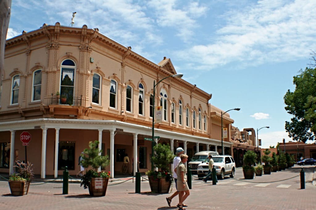
The capital of Sante Fe is also a great location for entering the northern half of the state. Great National monuments, forests, and parks are close by and accessible. Arguably one of the most beautiful and majestic, Santa Fe is one of the most popular and oldest cities in New Mexico and is also the capital of the state. The major cultural attractions of Santa Fe include the palace of the governor’s museum, located in the nation’s oldest public building with its permanent collection of more than 20000 artworks, including pieces of Ansell Adams, Georgia O’Keeffe, and Francisco de Goya.
This city is a major tourist attraction and sees massive tourism throughout the year. So if you are a passionate traveler and an art lover, you can travel even during the times of a global pandemic that we are facing today. Although what you must not miss is to backpack food that is healthy and hygienic which will help you resist the infection while enjoying the journey through the city of Santa Fe, New Mexico.
Thus, calling New Mexico beautiful would be putting barriers on its beauty, as it simply goes beyond that and there is probably nothing that you would not find in the state. All this makes New Mexico one of the best places for tourism with countless places to visit, even during the global pandemic that we are facing currently. Yes, you heard it right; planning a backpacking trip to the destination is what you can go for to break the monotony at this time.
Frequently Asked Questions
What is the most popular state park in New Mexico?
Bandelier National Monument
How many national parks are in New Mexico?
New Mexico has two national parks (Carlsbad Caverns, White Sands), two national historical parks (Chaco Culture, Pecos), one national heritage area (Northern Rio Grande), and 11 national monuments, including four administered by the Bureau of Land Management (BLM).
National Parks New Mexico
Kasha-Katuwe Tent Rocks National Monument
The Kasha-Katuwe Tent Rocks National Monument is a remarkable outdoor laboratory, offering an opportunity to observe, study, and experience the geologic processes that shape natural landscapes. The National Monument, on the Pajarito Plateau in north-central New Mexico, includes a national recreation trail and ranges from 5,570 feet to 6,760 feet above sea level. It is for foot travel only and contains two segments that provide opportunities for hiking, birdwatching, geologic observation, and plant identification.
The cone-shaped tent rock formations are the products of volcanic eruptions that occurred 6 to 7 million years ago and left pumice, ash, and tuff deposits over 1,000 feet thick. Tremendous explosions from the Jemez volcanic field spewed pyroclasts (rock fragments), while searing hot gases blasted down slopes in an incandescent avalanche called a pyroclastic flow.
Precariously perched on many of the tapering hoodoos are boulder caps that protect the softer pumice and tuff below. Some tents have lost their hard, resistant caprocks, and are disintegrating. While fairly uniform in shape, the tent rock formations vary in height from a few feet up to 90 feet.
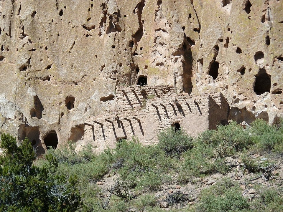
Bandelier National Monument
The Bandelier National Monument has an infrastructure that enables many types of people to enjoy one of the United States Archeological wonders. A true family-friendly environment with paths that wheelchairs can even enjoy. Walking up close to and around the ruins does require more mobility but the site can be broken down into different trails and allowing the person who wants to visit different aspects of the park to do so on separate trips over time.
The main loop trail is the main attraction, and making it to the Alcove Cave would be the most difficult due to the very large tall ladders. In this article, I will lay out the park according to each of the sections and show what each area looks like with photographs and videos.
The National Park Service website of the monument can be found here, and if you do want to hike the park there is a good map for sale in the gift shop. The free maps and information are great for the Pueblo Main Loop Trail and maybe the Alcove House, but the rest will need a great map. So enjoy the great fresh air, and have a great time exploring the park.
This 33,677-acre preserve is the Bandelier National Monument which encompasses some of the most incredibly stunning volcanic landscapes and archaeological ruins in the state. A few remains from this ancient site, which was formerly the home of the ancestral Pueblo people who occupied the area from AD1150 to 1600, include astonishing structures like masonry carves and dwellings, carved out of the volcanic rock.
White Sands National Park
Exploring the Southwest comes with an abundance of places to explore. New Mexico is no different one only needs to look at a map, and there south of Albuquerque is the White Sands National Monument. I drove in from the south, via an east to the west corridor through the top side of the Lincon National Forest.
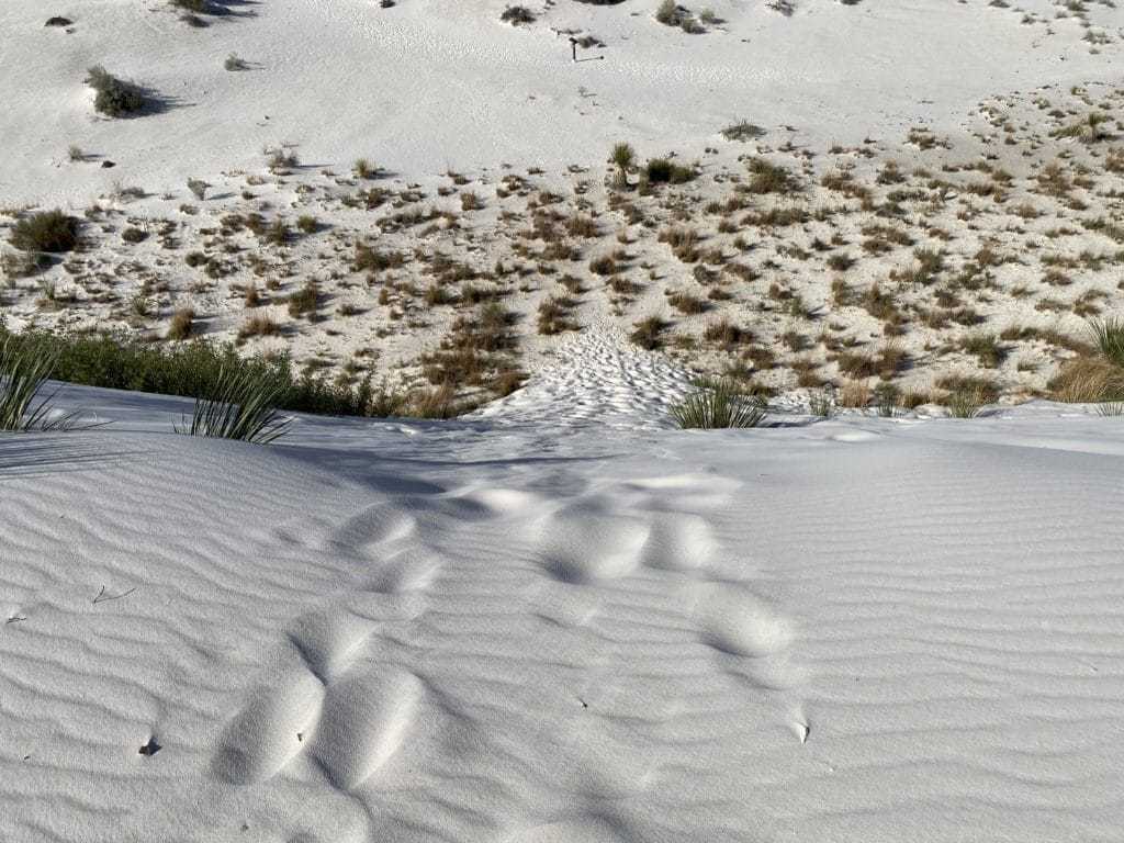
The largest gypsum dune field in the world is located within the White Sands National Monument in New Mexico. This region has glistening white dunes within the Chihuahuan Desert in the Tularosa Basin area. The monument’s range in elevation is around 3,890′ to 4116′ feet above sea level. The sand dunes cover around 275 total square miles, within 115 square miles area. Some of the most active dunes move across the northeast at a rate of up to 30 feet per year, and other areas of the dunes move very little over time while the more stable areas of sand move very little.
This park is unique and is covered in sand dunes. There are trails that you can walk, and explore the natural wonder of an environment covered in white sand.
Here is a video from my trip to White Sands National Monument and it has details from what it looks like and from a real personal experience. Nothing is staged and I do my best to give you the reader a good idea of what to expect. I also record the road out of the park to give some idea of what it looks like from the road.
Make sure to have your supplies ready to go since it is hot, windy, and very dry. Your clothing should cover your bare skin if you are sensitive to sunburns. An easy-to-access supply of water is also necessary before, during, and after so have plenty. A good hat really helps and the sun reflects back up from the sand so I found this critical. Shoes that can be drained of hot sand were also needed, and I stopped several times to just drain them of sand. I normally wear a loose short sleeve shirt, in these environments but a long sleeve lightweight shirt would have been better.
Petroglyph National Monument
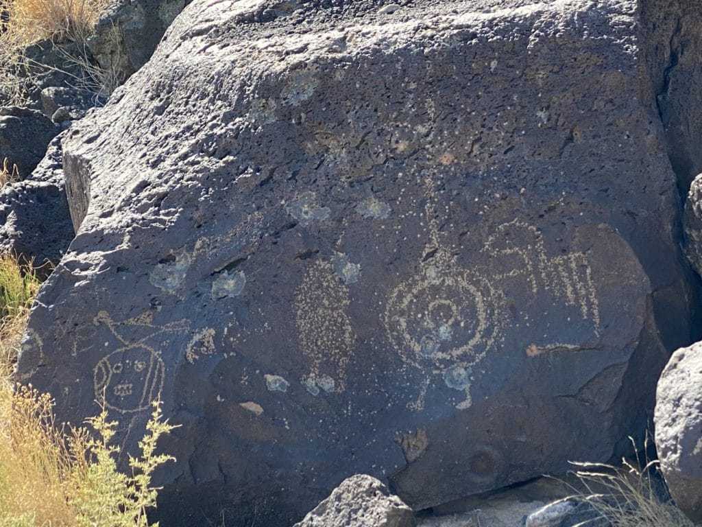
The Petroglyphs National Monument presents a unique environment where one can explore the past of the Pueblo people and enjoy a great hike in the process. The sites are broken into three separate trails. Each of them shows different petroglyphs and varies in size and type. Some can be seen up close and others require a keen eye. These glyphs are the product of people from thousands to hundreds of years ago understanding that removing the thin top layer of volcanic rock will leave a white presence against a black distinct background.
As you can see from all three of these trails that make up the Petroglyph National Monument they are a part of the Albuquerque national parks system that surrounds the area. All of these are day hikes that allow you to go back to your hotel room and rest before being back in the morning for several more hikes. Each petroglyph is a symbol of the people who once lived here, and a form of communication to people of the future. Their ancestors would also be something they would have wanted to exalt in some form, and this chipping away of the top black layer of volcanic rock.
Top hiking trails in Albuquerque
Some of the best Alburquerque hiking trails are within this area of petroglyphs and make up the Petroglyph National Monument and trail system. These trails are short and fairly easy to complete, and the time of year is what will determine how far you can hike, and what you can do in the hotter times of the year.
A series of four sites that has black volcanic rock. Some of the rocks have petroglyphs, and one of the sites has three small volcanoes.
Chaco Culture National Historical Park
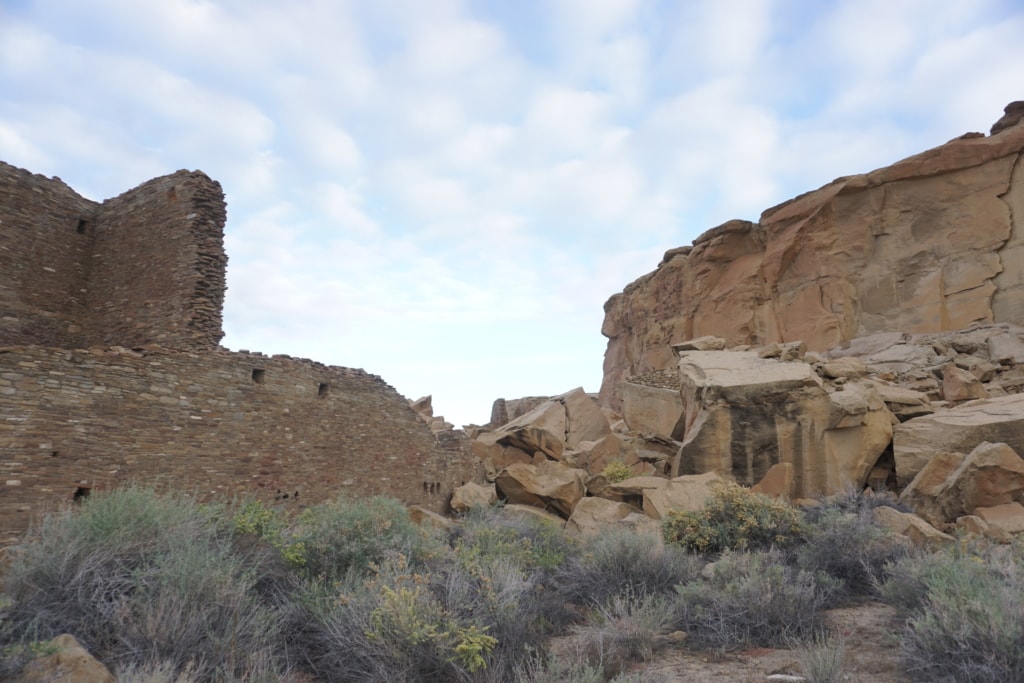
The park is laid out with two main loop roads with pullout areas that allow you to park your vehicle and then hike out on different trails. I found the rock formations to be impressive, but the ruins of the Pueblo Bonito Chacoan great house architecture to be very interesting and a great place to photograph the Chacoan culture. The Chacoan world covered an area of the present-day Southwest, that included the San Juan Basin of New Mexico, and portions of Colorado, Utah, and Arizona. Their influence lasted for over 300 years and included many peoples within its sphere of influence.
The Pueblo Bonito Site
This site is located a little more than 4 miles from the Visitor Center along the Canyon Loop Drive. This is considered the most important site within the canyon and an area you must consider seeing if you are on a short supply of time. The walk along the trail wraps around the archeology site and takes you within the ruins of the architecture of the Chaco peoples who constructed the site from AD 850 to AD 1150. The Chaco people were also ancestral Puebloan peoples similar to the people of the Bandelier National Monument.
Carlsbad Caverns National Park
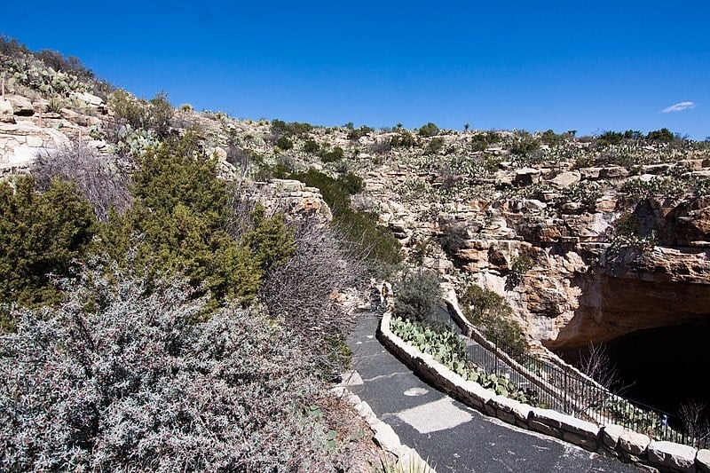
The Carlsbad Caverns National park is one of the most visited sites in New Mexico. It has approximately 120 known caves hidden mostly underground. Carved from limestone which is deposited in an ancient Sea, its underground landscape attracts thousands of tourists. Thus, if you are an enthusiast of archaeology and nature, this can be a treat for you. Besides, visitors can also experience bat tours, expeditions to specific caves, and walks through wondrous geographical formations.
Here since you are traveling amidst the pandemic, it is recommended to take along the best backpacking food to stay safe and healthy during the journey. Such meals are perfect for backcountry hikes and can be preserved for quite a long time.
High ancient sea ledges, deep rocky canyons, flowering cactus, and desert wildlife—treasures above the ground in the Chihuahuan Desert. Hidden beneath the surface are more than 119 caves—formed when sulfuric acid dissolved limestone leaving behind caverns of all sizes.
Natural Features & Ecosystems
 Jim White was the first person known to explore the depths of Carlsbad Cavern.NPS/Willis T. LeeCavesCarlsbad Caverns National Park contains more than 119 limestone caves that are outstanding in the profusion, diversity, and beauty of their formations. Caves are fragile environments that are affected by human activities and natural processes both underground and on the surface. Although caves are a delicate non-renewable resource, they are a continual source of exploration and discovery. more… 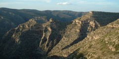 The park’s backcountry, including Yucca Canyon, can be extremely rugged.NPS photoGeologyCarlsbad Caverns National Park preserves a portion of the Capitan Reef—one of the best-preserved, exposed Permian-age fossil reefs in the world. Water, geologic forces, climactic changes, and vast spans of time have produced and changed the fossil reef and its spectacular caves, a process that continues to the present day. more… 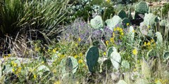 Rain showers can make the Chihuahuan Desert come alive with color throughout the year.NPS photoChihuahuan DesertCarlsbad Caverns National Park contains one of the few protected portions of the northern Chihuahuan Desert ecosystem. The Chihuahuan Desert reveals, upon close examination, complex natural processes that yield an astounding abundance and diversity of plant and animal life. more… |
Pecos National Historical Park
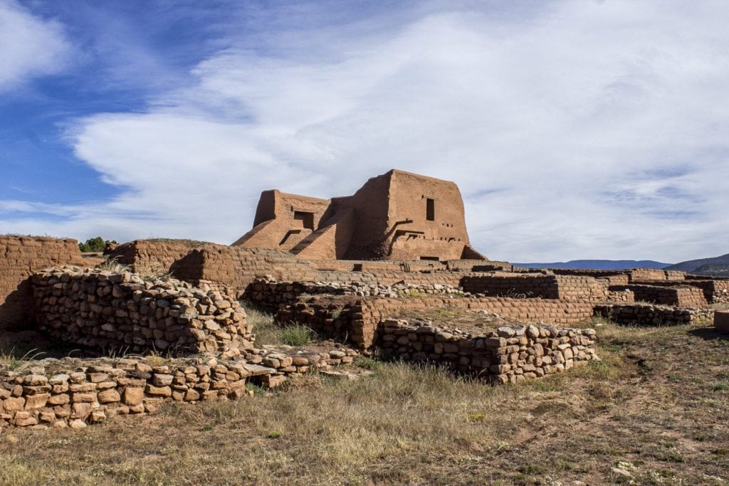
New Mexico is home to a lot of ancient and historical sites. The Pecos National Historical Park is one such site, which encompasses what was once, one of the largest Native American Pueblos in the state. The park is also home to the civil war battlefield of Glorieta Pass which can be toured through a 2.25-mile trail, without a guide.
Pecos National Historical Park is known not only for its rich cultural history but also for its natural resources. Explore each of the different types of flora, fauna, and geology that call Pecos home.
Past and present geological processes shaped the upper Pecos River Valley and its abundance of natural resources. In addition, the valley has been a significant migration corridor for people traveling the southern terminus of the Rocky Mountains, connecting the Great Plains with the Rio Grande Valley. Over 700 years ago, Pueblo people settled on a ridge in the middle of the valley that was surrounded by water sources, farmable land and building materials.
Pecos National Historical Park is situated in the upper Pecos River Valley which is bound to the north by the Sangre de Cristo Mountains, to the east by the Tecolote Range and to the south-southwest by Glorieta Mesa (known locally as Rowe Mesa). The valley has an average elevation of 7,000 feet above sea level and encompasses roughly 18 square miles. Glorieta Mesa is over 25 miles long, and the highest point, Cerro de Escobas is 8,212 feet above sea level. The topographic relief between the valley floor and mesa top can be over 1,000 feet and dramatically divides the landscape.
AdventureAlaskaAsiaBedouinsblogCaliforniaCebuChinaexploreexploretravelerFoodfoodiefood travelHikingHong KongIndonesiaIsraelJapanJerusalemJordanlifemalaysiaMiddle Eastnational parksNazarethpenangPetraPhilippinesphotographySan DiegoSan Diego ZooSouthern CaliforniasteemthatshareTaipeiTaitungTaiwanTaiwaneseThailandTokyotravelTravel TipsUSAWadi RumWashingtonWest Bank

